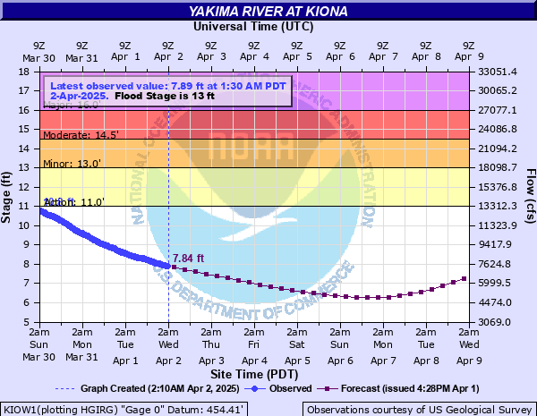
Yakima River at Kiona
Critical Stages
11' - Action
13' - Flood
14.5' - Moderate
16' - Major
Latest Observation
Updated: 8:30 AM PST 12/15/25
Status: Action
Stage: 12.38 ft
Flow: 16.2 kcfs
Forecast
| Time | Stage (ft) | Flow (kcfs) |
|---|---|---|
| 4 PM 12/15 | 11.27 | 14 |
| 10 PM 12/15 | 10.5 | 12.6 |
| 4 AM 12/16 | 9.86 | 11.4 |
| 10 AM 12/16 | 9.38 | 10.5 |
| 4 PM 12/16 | 9.16 | 10.1 |
| 10 PM 12/16 | 9.17 | 10.1 |
| 4 AM 12/17 | 9.42 | 10.6 |
| 10 AM 12/17 | 9.8 | 11.3 |
| 4 PM 12/17 | 10.27 | 12.1 |
| 10 PM 12/17 | 10.83 | 13.2 |
| 4 AM 12/18 | 11.47 | 14.4 |
| 10 AM 12/18 | 12.09 | 15.6 |
| 4 PM 12/18 | 12.69 | 17.2 |
| 10 PM 12/18 | 13.2 | 18.7 |
| 4 AM 12/19 | 13.57 | 19.8 |
| 10 AM 12/19 | 13.86 | 20.7 |
| 4 PM 12/19 | 14.04 | 21.2 |
| 10 PM 12/19 | 14.1 | 21.4 |
| 4 AM 12/20 | 14.06 | 21.3 |
| 10 AM 12/20 | 13.95 | 20.9 |
| 4 PM 12/20 | 13.79 | 20.5 |
| 10 PM 12/20 | 13.59 | 19.9 |
| 4 AM 12/21 | 13.37 | 19.2 |
| 10 AM 12/21 | 13.14 | 18.5 |
| 4 PM 12/21 | 12.82 | 17.6 |
| 10 PM 12/21 | 12.44 | 16.4 |
| 4 AM 12/22 | 12.01 | 15.4 |
| 10 AM 12/22 | 11.55 | 14.5 |
| 4 PM 12/22 | 11.11 | 13.7 |
| 10 PM 12/22 | 10.68 | 12.9 |
| 4 AM 12/23 | 10.25 | 12.1 |
| 10 AM 12/23 | 9.8 | 11.3 |
| 4 PM 12/23 | 9.35 | 10.5 |
| 10 PM 12/23 | 8.95 | 9.76 |
| 4 AM 12/24 | 8.64 | 9.22 |
| 10 AM 12/24 | 8.44 | 8.88 |
| 4 PM 12/24 | 8.29 | 8.62 |
| 10 PM 12/24 | 8.16 | 8.4 |
| 4 AM 12/25 | 8.08 | 8.27 |
| Time | Stage (ft) | Flow (kcfs) |
|---|---|---|
| 9:30 AM 12/15 | 12.22 | 15.8 |
| 9:15 AM 12/15 | 12.23 | 15.9 |
| 9:00 AM 12/15 | 12.26 | 15.9 |
| 8:45 AM 12/15 | 12.32 | 16.1 |
| 8:30 AM 12/15 | 12.38 | 16.2 |
| 8:15 AM 12/15 | 12.4 | 16.3 |
| 8:00 AM 12/15 | 12.43 | 16.4 |
| 7:45 AM 12/15 | 12.46 | 16.5 |
| 7:30 AM 12/15 | 12.48 | 16.5 |
| 7:15 AM 12/15 | 12.52 | 16.7 |
| 7:00 AM 12/15 | 12.57 | 16.8 |
| 6:45 AM 12/15 | 12.6 | 16.9 |
| 6:30 AM 12/15 | 12.62 | 17 |
| 6:15 AM 12/15 | 12.68 | 17.1 |
| 6:00 AM 12/15 | 12.78 | 17.4 |
| 5:45 AM 12/15 | 12.79 | 17.5 |
| 5:30 AM 12/15 | 12.77 | 17.4 |
| 5:15 AM 12/15 | 12.79 | 17.5 |
| 5:00 AM 12/15 | 12.82 | 17.6 |
| 4:45 AM 12/15 | 12.86 | 17.7 |
| 4:30 AM 12/15 | 12.99 | 18.1 |
| 4:15 AM 12/15 | 13.04 | 18.2 |
| 4:00 AM 12/15 | 12.94 | 17.9 |
| 3:45 AM 12/15 | 13.11 | 18.4 |
| 3:30 AM 12/15 | 13.05 | 18.2 |
| 3:15 AM 12/15 | 13.04 | 18.2 |
| 3:00 AM 12/15 | 13.09 | 18.4 |
| 2:45 AM 12/15 | 13.12 | 18.5 |
| 2:30 AM 12/15 | 13.16 | 18.6 |
| 2:15 AM 12/15 | 13.17 | 18.6 |
20' -
There will be flooding of in the RV Park in Benton City along the river. There will extensive flooding in the West Richland area from Twin Bridge to the Columbia River, including the West Richland Golf Course and along Kingston...Hyde and Jones roads.
16' -
There will be flooding of in the RV Park in Benton City along the river. There will extensive flooding in the West Richland area from Twin Bridge to the Columbia River, including the West Richland Golf Course and along Kingston...Hyde and Jones roads.
14.5' -
At this level, there will be moderate flooding of farmland, roads and some residential areas...especially in the West Richland area.
13' -
There will be minor flooding of pastures and roads adjacent to the river...especially in low lying areas of West Richland.
| Date | Stage (ft) |
|---|---|
| Dec 23, 1933 | 21.57 |
| Feb 11, 1996 | 20.98 |
| Nov 17, 1906 | 20.12 |
| Jan 18, 1974 | 18.65 |
| May 31, 1948 | 17.2 |
| Dec 6, 1975 | 16.52 |
| Dec 28, 1980 | 16.27 |
| Dec 4, 1977 | 16.11 |
| Dec 2, 1995 | 15.88 |
| Jan 11, 2009 | 15.55 |
| May 18, 2011 | 15.3 |
| Apr 17, 1904 | 15.05 |
| Nov 26, 1909 | 14.8 |
| Jan 20, 2011 | 14.78 |
| Dec 12, 2015 | 14.71 |
| Feb 22, 1982 | 14.42 |
| Nov 27, 1990 | 14.36 |
| Mar 3, 1901 | 14 |
| Feb 1, 1965 | 13.76 |
| Mar 15, 1972 | 13.57 |
Data provided by the National Weather Service.