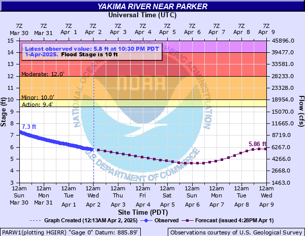
Yakima River near Parker
Critical Stages
9.4' - Action
10' - Flood
12' - Moderate
14' - Major
Latest Observation
Updated: 8:30 AM PST 12/15/25
Status: No Flooding
Stage: 6.73 ft
Flow: 7.99 kcfs
Forecast
| Time | Stage (ft) | Flow (kcfs) |
|---|---|---|
| 4 PM 12/15 | 6.74 | 8.02 |
| 10 PM 12/15 | 6.86 | 8.34 |
| 4 AM 12/16 | 7.18 | 9.22 |
| 10 AM 12/16 | 7.52 | 10.2 |
| 4 PM 12/16 | 7.71 | 10.8 |
| 10 PM 12/16 | 7.85 | 11.2 |
| 4 AM 12/17 | 8.13 | 12.1 |
| 10 AM 12/17 | 8.69 | 14 |
| 4 PM 12/17 | 9.46 | 16.8 |
| 10 PM 12/17 | 10.14 | 19.5 |
| 4 AM 12/18 | 10.41 | 20.7 |
| 10 AM 12/18 | 10.22 | 19.9 |
| 4 PM 12/18 | 9.77 | 18 |
| 10 PM 12/18 | 9.29 | 16.1 |
| 4 AM 12/19 | 8.93 | 14.8 |
| 10 AM 12/19 | 8.76 | 14.2 |
| 4 PM 12/19 | 8.69 | 14 |
| 10 PM 12/19 | 8.61 | 13.7 |
| 4 AM 12/20 | 8.47 | 13.2 |
| 10 AM 12/20 | 8.28 | 12.6 |
| 4 PM 12/20 | 8.06 | 11.9 |
| 10 PM 12/20 | 7.85 | 11.2 |
| 4 AM 12/21 | 7.64 | 10.6 |
| 10 AM 12/21 | 7.45 | 9.99 |
| 4 PM 12/21 | 7.28 | 9.51 |
| 10 PM 12/21 | 7.13 | 9.08 |
| 4 AM 12/22 | 6.99 | 8.69 |
| 10 AM 12/22 | 6.86 | 8.34 |
| 4 PM 12/22 | 6.72 | 7.97 |
| 10 PM 12/22 | 6.57 | 7.59 |
| 4 AM 12/23 | 6.44 | 7.28 |
| 10 AM 12/23 | 6.34 | 7.04 |
| 4 PM 12/23 | 6.26 | 6.85 |
| 10 PM 12/23 | 6.18 | 6.67 |
| 4 AM 12/24 | 6.12 | 6.53 |
| 10 AM 12/24 | 6.06 | 6.4 |
| 4 PM 12/24 | 6 | 6.27 |
| 10 PM 12/24 | 5.94 | 6.14 |
| 4 AM 12/25 | 5.89 | 6.03 |
| Time | Stage (ft) | Flow (kcfs) |
|---|---|---|
| 8:30 AM 12/15 | 6.73 | 7.99 |
| 8:15 AM 12/15 | 6.74 | 8.02 |
| 8:00 AM 12/15 | 6.75 | 8.04 |
| 7:45 AM 12/15 | 6.76 | 8.07 |
| 7:30 AM 12/15 | 6.76 | 8.07 |
| 7:15 AM 12/15 | 6.77 | 8.1 |
| 7:00 AM 12/15 | 6.77 | 8.1 |
| 6:45 AM 12/15 | 6.78 | 8.12 |
| 6:30 AM 12/15 | 6.78 | 8.12 |
| 6:15 AM 12/15 | 6.79 | 8.15 |
| 6:00 AM 12/15 | 6.8 | 8.18 |
| 5:45 AM 12/15 | 6.8 | 8.18 |
| 5:30 AM 12/15 | 6.82 | 8.23 |
| 5:15 AM 12/15 | 6.82 | 8.23 |
| 5:00 AM 12/15 | 6.83 | 8.26 |
| 4:45 AM 12/15 | 6.84 | 8.28 |
| 4:30 AM 12/15 | 6.84 | 8.28 |
| 4:15 AM 12/15 | 6.84 | 8.28 |
| 4:00 AM 12/15 | 6.86 | 8.34 |
| 3:45 AM 12/15 | 6.86 | 8.34 |
| 3:30 AM 12/15 | 6.87 | 8.36 |
| 3:15 AM 12/15 | 6.88 | 8.39 |
| 3:00 AM 12/15 | 6.89 | 8.42 |
| 2:45 AM 12/15 | 6.9 | 8.45 |
| 2:30 AM 12/15 | 6.91 | 8.47 |
| 2:15 AM 12/15 | 6.92 | 8.5 |
| 2:00 AM 12/15 | 6.92 | 8.5 |
| 1:45 AM 12/15 | 6.93 | 8.53 |
| 1:30 AM 12/15 | 6.94 | 8.55 |
| 1:15 AM 12/15 | 6.95 | 8.58 |
15' -
At this level, severe flooding from Selah to Prosser with major damage to homes and buildings, pastures, roads and bridges. There will be severe flooding in Wapato, Donald, Buena and Toppenish.
14' -
There will be widespread flooding of agricultural land, farm buildings, roads and highways from Selah to Prosser. There will be major flooding in Donald, Toppenish and Buena with major erosion damage to bridges, embankments and topsoils.
13' -
Widespread flooding of agricultural land, farm building, county roads and highways from Selah downstream to Prosser.
12' -
There will be flooding of farmland and county roads. Some homes and farm buildings will be flooded and there will be significant riverbank and topsoil erosion.
11' -
At this level, widespread minor flooding of farmland and county roads along the river will be noted.
10' -
There will be minor flooding of pastures and farm roads adjacent to the river.
| Date | Stage (ft) |
|---|---|
| Feb 9, 1996 | 16.21 |
| Dec 23, 1933 | 15 |
| Nov 30, 1995 | 14.61 |
| Nov 26, 1990 | 14.5 |
| Dec 3, 1977 | 13.97 |
| Dec 27, 1980 | 13.44 |
| Jan 16, 1974 | 13.35 |
| May 16, 2011 | 13.2 |
| Dec 4, 1975 | 13.14 |
| Jan 9, 2009 | 13.03 |
| Jan 18, 2011 | 12.2 |
| Dec 10, 2015 | 12.15 |
| Mar 14, 1972 | 11.65 |
| Jan 31, 1965 | 11.65 |
| Feb 21, 1982 | 11.61 |
| Jan 25, 1984 | 11.41 |
| Apr 1, 2011 | 11.3 |
| Feb 21, 1995 | 11.28 |
| Feb 16, 2016 | 10.93 |
| Feb 1, 1995 | 10.75 |
Data provided by the National Weather Service.