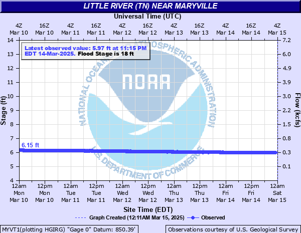
Little River (TN) near Maryville
Critical Stages
15' - Action
18' - Flood
21' - Moderate
24' - Major
Latest Observation
Updated: 12:15 AM EST 12/15/25
Status: No Flooding
Stage: 5.61 ft
Flow: 0.178 kcfs
Forecast
Forecast not available for this location.
| Time | Stage (ft) | Flow (kcfs) |
|---|---|---|
| 1:15 AM 12/15 | 5.6 | 0.176 |
| 1:00 AM 12/15 | 5.61 | 0.178 |
| 12:45 AM 12/15 | 5.61 | 0.178 |
| 12:30 AM 12/15 | 5.6 | 0.176 |
| 12:15 AM 12/15 | 5.61 | 0.178 |
| 12:00 AM 12/15 | 5.61 | 0.178 |
| 11:45 PM 12/14 | 5.61 | 0.178 |
| 11:30 PM 12/14 | 5.61 | 0.178 |
| 11:15 PM 12/14 | 5.61 | 0.178 |
| 11:00 PM 12/14 | 5.61 | 0.178 |
| 10:45 PM 12/14 | 5.61 | 0.178 |
| 10:30 PM 12/14 | 5.61 | 0.178 |
| 10:15 PM 12/14 | 5.61 | 0.178 |
| 10:00 PM 12/14 | 5.61 | 0.178 |
| 9:45 PM 12/14 | 5.61 | 0.178 |
| 9:30 PM 12/14 | 5.61 | 0.178 |
| 9:15 PM 12/14 | 5.61 | 0.178 |
| 9:00 PM 12/14 | 5.61 | 0.178 |
| 8:45 PM 12/14 | 5.61 | 0.178 |
| 8:30 PM 12/14 | 5.61 | 0.178 |
| 8:15 PM 12/14 | 5.61 | 0.178 |
| 8:00 PM 12/14 | 5.61 | 0.178 |
| 7:45 PM 12/14 | 5.61 | 0.178 |
| 7:30 PM 12/14 | 5.6 | 0.176 |
| 7:15 PM 12/14 | 5.61 | 0.178 |
| 7:00 PM 12/14 | 5.61 | 0.178 |
| 6:45 PM 12/14 | 5.61 | 0.178 |
| 6:30 PM 12/14 | 5.61 | 0.178 |
| 6:15 PM 12/14 | 5.61 | 0.178 |
| 6:00 PM 12/14 | 5.6 | 0.176 |
32' -
Additional riverfront homes on Creekstone Circle take water.
31' -
Living spaces of some riverfront homes on Creekstone Circle may begin to take water. The river reaches the bottom of the Hwy 411 bridge. The pump house has six feet of water.
28' -
Water reaches the bottom of the pumping equipment in the pump house near the Hwy 411 bridge.
27' -
Water begins to enter a dwelling's pool and garage near the corner of Davis Ford Road and Creekstone Circle.
25' -
The river reaches the floor of the pump house near the Highway 411 bridge.
23' -
Water reaches the bottom floors of the two cabins on Old Walland Hwy 0.6 miles upstream from its intersection with Ellejoy Road.
22' -
Backyards of riverfront homes on Creekstone Circle are at least half-way inundated. Stretches of Davis Ford Road along the river are flooded. Water reaches the surface of the Ellejoy Road bridge near the intersection of River Ford Road.
21.5' -
Water covers Old Walland Highway where two cabins are 0.6 miles upstream from its intersection with Ellejoy Road.
21' -
Stretches of Ellejoy Road and River Ford Road are flooded. Shed structures near the Wildwood Road bridge begin to take water.
19' -
Water reaches the slab of a neighborhood's riverside pavilion near Davis Ford Road and Creekstone Circle.
18' -
Low spots along Ellejoy Road and River Ford Road have begun to flood. Agricultural land near Highway 411 is flooded.
| Date | Stage (ft) |
|---|---|
| Feb 25, 1875 | 31 |
| Mar 28, 1994 | 27.95 |
| Apr 1, 1896 | 26 |
| May 6, 2003 | 24.42 |
| Mar 12, 1963 | 24.2 |
| Apr 1, 1920 | 24 |
| Feb 6, 2020 | 22.85 |
| Mar 16, 1973 | 22.84 |
| Mar 26, 1965 | 22.83 |
| Feb 23, 2019 | 22.14 |
| Apr 19, 1998 | 21.28 |
| Feb 1, 1957 | 21.18 |
| Apr 7, 1964 | 21.17 |
| Mar 29, 1951 | 21.05 |
| Apr 5, 1977 | 20.92 |
| Feb 13, 1966 | 20.86 |
| Mar 17, 2002 | 20.83 |
| Dec 18, 1961 | 20.8 |
| May 8, 1984 | 20.48 |
| Jul 19, 1971 | 20.34 |
Data provided by the National Weather Service.