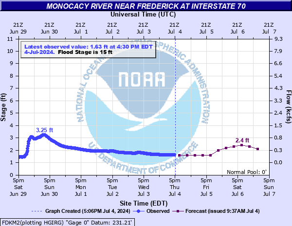
Monocacy River near Frederick at Interstate 70
Critical Stages
13' - Action
15' - Flood
17' - Moderate
20' - Major
Latest Observation
Updated: 7:30 AM EST 12/6/25
Status: No Flooding
Stage: 1.99 ft
Flow: 0.279 kcfs
Forecast
| Time | Stage (ft) | Flow (kcfs) |
|---|---|---|
| 1 PM 12/6 | 1.7 | 0.191 |
| 7 PM 12/6 | 1.7 | 0.191 |
| 1 AM 12/7 | 1.7 | 0.191 |
| 7 AM 12/7 | 1.7 | 0.191 |
| 1 PM 12/7 | 1.7 | 0.191 |
| 7 PM 12/7 | 1.7 | 0.191 |
| 1 AM 12/8 | 1.6 | 0.162 |
| 7 AM 12/8 | 1.6 | 0.162 |
| Time | Stage (ft) | Flow (kcfs) |
|---|---|---|
| 7:30 AM 12/6 | 1.99 | 0.279 |
| 7:15 AM 12/6 | 1.99 | 0.279 |
| 7:00 AM 12/6 | 2 | 0.282 |
| 6:45 AM 12/6 | 2 | 0.282 |
| 6:30 AM 12/6 | 2 | 0.282 |
| 6:15 AM 12/6 | 2 | 0.282 |
| 6:00 AM 12/6 | 2 | 0.282 |
| 5:45 AM 12/6 | 2 | 0.282 |
| 5:30 AM 12/6 | 2.01 | 0.285 |
| 5:15 AM 12/6 | 2.01 | 0.285 |
| 5:00 AM 12/6 | 2.01 | 0.285 |
| 4:45 AM 12/6 | 2.01 | 0.285 |
| 4:30 AM 12/6 | 2.01 | 0.285 |
| 4:15 AM 12/6 | 2.02 | 0.288 |
| 4:00 AM 12/6 | 2.02 | 0.288 |
| 3:45 AM 12/6 | 2.02 | 0.288 |
| 3:30 AM 12/6 | 2.02 | 0.288 |
| 3:15 AM 12/6 | 2.02 | 0.288 |
| 3:00 AM 12/6 | 2.02 | 0.288 |
| 2:45 AM 12/6 | 2.03 | 0.291 |
| 2:30 AM 12/6 | 2.03 | 0.291 |
| 2:15 AM 12/6 | 2.03 | 0.291 |
| 2:00 AM 12/6 | 2.03 | 0.291 |
| 1:45 AM 12/6 | 2.03 | 0.291 |
| 1:30 AM 12/6 | 2.03 | 0.291 |
| 1:15 AM 12/6 | 2.03 | 0.291 |
| 1:00 AM 12/6 | 2.04 | 0.295 |
| 12:45 AM 12/6 | 2.04 | 0.295 |
| 12:30 AM 12/6 | 2.04 | 0.295 |
| 12:15 AM 12/6 | 2.04 | 0.295 |
30' -
Water reaches the second floor of Gambrill Mill on the Monocacy National Battlefield.
24' -
Water approaches Urbana Pike near Monocacy National Battlefield.
21' -
Maryland Route 26 is flooded near the Monocacy River bridge.
20' -
Water reaches Gambrill Mill on the Monocacy National Battlefield.
17' -
Significant lowland flooding is occurring along the river, with backwater flooding also occurring. Numerous roads are closed. Water is approaching the parking lot at Gambrill Mill on the Monocacy National Battlefield. Backwater flooding from Carroll Creek is likely approaching the underside of the bridge leading to the Frederick city wastewater treatment plant.
16' -
Much of Pinecliff Park and Rivermist Park in Frederick are flooded. Buckeystown Community Park is also flooded with water approaching the parking lot. Waters are also approaching the Frederick city wastewater treatment plant and the Ballenger Creek wastewater treatment plant. Significant backwater flooding is occurring. Several roads will be closed along the river and adjoining creeks.
15' -
Both banks of the river are flooded. Water begins to flood low-lying fields at Monocacy National Battlefield. Water reaches the access road of the Frederick city wastewater treatment plant. Backwater flooding is occurring on several area creeks, particularly Carroll Creek in Frederick.
14' -
Two low-water crossings, one on Michaels Mill Road /State Route 880/ in Buckeystown, and one on Retreat Road north of Frederick, begin to flood.
13' -
Water covers portions of Pinecliff Park in southeast Frederick. Water also approaches Rivermist Park in northeast Frederick.
10' -
The east side of the Monocacy River, or left bank, begins to flood east of Frederick. Although no structures are affected, water approaches an access road at Pinecliff Park.
5' -
After rain events, the river may become hazardous for recreational purposes when stages are over 5 feet.
| Date | Stage (ft) |
|---|---|
| Jun 23, 1972 | 35.9 |
| Sep 26, 1975 | 30.8 |
| Aug 24, 1933 | 28.1 |
| Oct 10, 1976 | 25.38 |
| Jan 20, 1996 | 23.67 |
| Jun 20, 1996 | 22.54 |
| Sep 2, 2021 | 22.1 |
| Sep 6, 1979 | 22.03 |
| Oct 31, 2012 | 21.77 |
| Apr 27, 1937 | 21.7 |
| Sep 17, 1934 | 21.6 |
| Sep 10, 2018 | 21.36 |
| Jul 13, 1949 | 21.3 |
| Dec 12, 2003 | 20.92 |
| Dec 6, 1993 | 20.64 |
| Apr 18, 2011 | 20.61 |
| Jan 27, 1978 | 20.33 |
| Aug 14, 1942 | 20.29 |
| Jan 25, 1979 | 20.25 |
| Nov 29, 1993 | 20.13 |
Data provided by the National Weather Service.