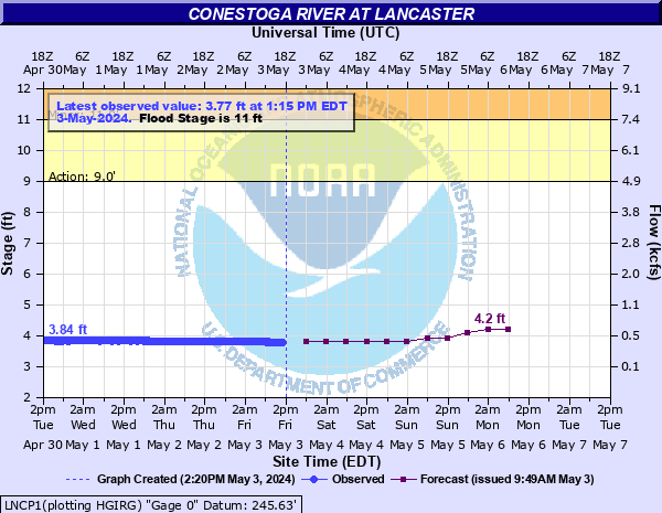
Conestoga River at Lancaster
Critical Stages
9' - Action
11' - Flood
13' - Moderate
15' - Major
Latest Observation
Updated: 7:15 AM EST 12/6/25
Status: No Flooding
Stage: 3.28 ft
Flow: 0.146 kcfs
Forecast
| Time | Stage (ft) | Flow (kcfs) |
|---|---|---|
| 1 PM 12/6 | 3.3 | 0.152 |
| 7 PM 12/6 | 3.3 | 0.152 |
| 1 AM 12/7 | 3.3 | 0.152 |
| 7 AM 12/7 | 3.3 | 0.152 |
| 1 PM 12/7 | 3.3 | 0.152 |
| 7 PM 12/7 | 3.2 | 0.124 |
| 1 AM 12/8 | 3.2 | 0.124 |
| 7 AM 12/8 | 3.2 | 0.124 |
| Time | Stage (ft) | Flow (kcfs) |
|---|---|---|
| 8:15 AM 12/6 | 3.27 | 0.143 |
| 8:00 AM 12/6 | 3.28 | 0.146 |
| 7:45 AM 12/6 | 3.28 | 0.146 |
| 7:15 AM 12/6 | 3.28 | 0.146 |
| 7:00 AM 12/6 | 3.28 | 0.146 |
| 6:45 AM 12/6 | 3.28 | 0.146 |
| 6:15 AM 12/6 | 3.28 | 0.146 |
| 6:00 AM 12/6 | 3.28 | 0.146 |
| 5:45 AM 12/6 | 3.28 | 0.146 |
| 5:15 AM 12/6 | 3.28 | 0.146 |
| 5:00 AM 12/6 | 3.28 | 0.146 |
| 4:45 AM 12/6 | 3.29 | 0.149 |
| 4:15 AM 12/6 | 3.29 | 0.149 |
| 4:00 AM 12/6 | 3.29 | 0.149 |
| 3:45 AM 12/6 | 3.29 | 0.149 |
| 3:15 AM 12/6 | 3.29 | 0.149 |
| 3:00 AM 12/6 | 3.29 | 0.149 |
| 2:45 AM 12/6 | 3.29 | 0.149 |
| 2:15 AM 12/6 | 3.29 | 0.149 |
| 2:00 AM 12/6 | 3.29 | 0.149 |
| 1:46 AM 12/6 | 3.29 | 0.149 |
| 1:45 AM 12/6 | 3.29 | 0.149 |
| 1:15 AM 12/6 | 3.29 | 0.149 |
| 1:00 AM 12/6 | 3.29 | 0.149 |
| 12:45 AM 12/6 | 3.29 | 0.149 |
| 12:15 AM 12/6 | 3.29 | 0.149 |
| 12:00 AM 12/6 | 3.29 | 0.149 |
| 11:45 PM 12/5 | 3.3 | 0.152 |
| 11:15 PM 12/5 | 3.3 | 0.152 |
| 11:00 PM 12/5 | 3.3 | 0.152 |
34.6' -
Approximate level of the FEMA 0.2 0X0P+0nnual Chance Flood level (500-year flood).
27.9' -
Flood of record from Hurricane Agnes in 1972.
27' -
Flood waters begin to reach the South Duke Street Bridge.
26.1' -
Approximate level of the FEMA 1 0X0P+0nnual Chance Flood level (100-year flood).
22.6' -
Flood waters begin to reach the New Holland Pike Bridge, and the Eden Road Bridge. Approximate level of the FEMA 2 0X0P+0nnual Chance Flood level (50-year flood).
20' -
Flood waters begin to reach the East King Street Bridge, the East Strawberry Street Bridge and the bridge at the water treatment facility.
17' -
Flood waters begin to reach the Hunsecker's Mill Covered Bridge.
15.6' -
Approximate level of the FEMA 10 0X0P+0nnual Chance Flood level (10-year flood).
15' -
Many homes near the river are affected by high water.
14' -
The footbridge near the confluence of Stauffer Run begins to flood.
13' -
Several homes are affected by high water.
11' -
Grofftown Road will flood.
| Date | Stage (ft) |
|---|---|
| Jun 23, 1972 | 27.9 |
| Sep 8, 2011 | 21.3 |
| Sep 2, 2021 | 18.49 |
| Jan 25, 1978 | 18.14 |
| Oct 9, 2005 | 17.8 |
| Aug 24, 1933 | 17.52 |
| Sep 9, 1987 | 16.7 |
| Sep 17, 1999 | 16.39 |
| May 6, 1989 | 15.3 |
| Jun 28, 2006 | 14.7 |
| Aug 4, 2018 | 14.28 |
| Oct 30, 2012 | 14.27 |
| Jun 17, 1982 | 14.2 |
| Sep 30, 1934 | 14.04 |
| Jan 25, 1979 | 13.96 |
| Feb 26, 1979 | 13.87 |
| Aug 22, 2018 | 13.86 |
| Aug 22, 2018 | 13.86 |
| Dec 5, 1993 | 13.78 |
| Dec 18, 2023 | 13.25 |
Data provided by the National Weather Service.