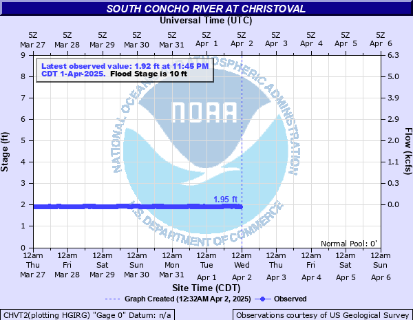
South Concho River at Christoval
Critical Stages
9' - Action
10' - Flood
12' - Moderate
16' - Major
Latest Observation
Updated: 4:05 AM CST 12/16/25
Status: No Flooding
Stage: 1.94 ft
Flow: 0.0093 kcfs
Forecast
Forecast not available for this location.
| Time | Stage (ft) | Flow (kcfs) |
|---|---|---|
| 4:20 AM 12/16 | 1.94 | 0.0093 |
| 4:15 AM 12/16 | 1.94 | 0.0093 |
| 4:10 AM 12/16 | 1.94 | 0.0093 |
| 4:05 AM 12/16 | 1.94 | 0.0093 |
| 4:00 AM 12/16 | 1.94 | 0.0093 |
| 3:55 AM 12/16 | 1.94 | 0.0093 |
| 3:50 AM 12/16 | 1.94 | 0.0093 |
| 3:45 AM 12/16 | 1.94 | 0.0093 |
| 3:40 AM 12/16 | 1.93 | 0.0087 |
| 3:35 AM 12/16 | 1.94 | 0.0093 |
| 3:30 AM 12/16 | 1.94 | 0.0093 |
| 3:25 AM 12/16 | 1.93 | 0.0087 |
| 3:20 AM 12/16 | 1.94 | 0.0093 |
| 3:15 AM 12/16 | 1.93 | 0.0087 |
| 3:10 AM 12/16 | 1.94 | 0.0093 |
| 3:05 AM 12/16 | 1.93 | 0.0087 |
| 3:00 AM 12/16 | 1.93 | 0.0087 |
| 2:55 AM 12/16 | 1.94 | 0.0093 |
| 2:50 AM 12/16 | 1.93 | 0.0087 |
| 2:45 AM 12/16 | 1.93 | 0.0087 |
| 2:40 AM 12/16 | 1.93 | 0.0087 |
| 2:35 AM 12/16 | 1.94 | 0.0093 |
| 2:30 AM 12/16 | 1.93 | 0.0087 |
| 2:25 AM 12/16 | 1.93 | 0.0087 |
| 2:20 AM 12/16 | 1.93 | 0.0087 |
| 2:15 AM 12/16 | 1.93 | 0.0087 |
| 2:10 AM 12/16 | 1.93 | 0.0087 |
| 2:05 AM 12/16 | 1.93 | 0.0087 |
| 2:00 AM 12/16 | 1.94 | 0.0093 |
| 1:55 AM 12/16 | 1.93 | 0.0087 |
20' -
Severe flooding will occur in Christoval. Many roads will be flooded and impassible. Numerous structures will be flooded.
16' -
Major flooding will occur in Christoval. Several structures will be flooded. Roads and low water crossings will be impassible.
12' -
Moderate flooding will occur. Most of the city recreation area will be under water and a few houses near the river will be flooded.
10' -
Minor flooding will occur. The city recreation area will begin to flood.
| Date | Stage (ft) |
|---|---|
| Aug 6, 1906 | 23 |
| Jul 23, 1938 | 21.95 |
| May 9, 1957 | 20.82 |
| Sep 17, 1936 | 20.5 |
| Oct 13, 1930 | 20.2 |
| Apr 26, 1957 | 16.3 |
| Sep 22, 1990 | 14.05 |
| Oct 18, 2018 | 13.91 |
| Oct 3, 1959 | 13.85 |
| Oct 9, 1961 | 12.48 |
| Sep 21, 2018 | 12.45 |
| May 30, 1971 | 11.51 |
| Sep 8, 1980 | 11.48 |
| Jul 3, 1932 | 11.18 |
| May 10, 1937 | 11 |
| Oct 13, 1973 | 10.86 |
| Jun 17, 1958 | 10.73 |
| Aug 28, 2001 | 10.54 |
| Jun 18, 1961 | 10.5 |
| Sep 24, 1964 | 10.2 |
Data provided by the National Weather Service.