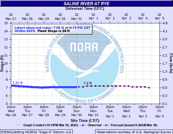
Saline River at Rye
Critical Stages
24' - Action
26' - Flood
29' - Moderate
30' - Major
Latest Observation
Updated: 11:15 PM CST 12/14/25
Status: No Flooding
Stage: 5.97 ft
Flow: 0.254 kcfs
Forecast
| Time | Stage (ft) | Flow (kcfs) |
|---|---|---|
| 6 AM 12/15 | 5.9 | 0.238 |
| 12 PM 12/15 | 5.9 | 0.238 |
| 6 PM 12/15 | 5.9 | 0.238 |
| 12 AM 12/16 | 5.9 | 0.238 |
| 6 AM 12/16 | 5.9 | 0.238 |
| 12 PM 12/16 | 5.8 | 0.216 |
| 6 PM 12/16 | 5.8 | 0.216 |
| 12 AM 12/17 | 5.8 | 0.216 |
| 6 AM 12/17 | 5.8 | 0.216 |
| 12 PM 12/17 | 5.7 | 0.196 |
| 6 PM 12/17 | 5.7 | 0.196 |
| 12 AM 12/18 | 5.7 | 0.196 |
| 6 AM 12/18 | 5.7 | 0.196 |
| 12 PM 12/18 | 5.7 | 0.196 |
| 6 PM 12/18 | 5.6 | 0.177 |
| 12 AM 12/19 | 5.6 | 0.177 |
| 6 AM 12/19 | 5.6 | 0.177 |
| Time | Stage (ft) | Flow (kcfs) |
|---|---|---|
| 12:15 AM 12/15 | 5.96 | 0.252 |
| 12:00 AM 12/15 | 5.96 | 0.252 |
| 11:45 PM 12/14 | 5.96 | 0.252 |
| 11:30 PM 12/14 | 5.96 | 0.252 |
| 11:15 PM 12/14 | 5.97 | 0.254 |
| 11:00 PM 12/14 | 5.97 | 0.254 |
| 10:45 PM 12/14 | 5.97 | 0.254 |
| 10:30 PM 12/14 | 5.97 | 0.254 |
| 10:15 PM 12/14 | 5.97 | 0.254 |
| 10:00 PM 12/14 | 5.97 | 0.254 |
| 9:45 PM 12/14 | 5.97 | 0.254 |
| 9:30 PM 12/14 | 5.97 | 0.254 |
| 9:15 PM 12/14 | 5.97 | 0.254 |
| 9:00 PM 12/14 | 5.97 | 0.254 |
| 8:45 PM 12/14 | 5.97 | 0.254 |
| 8:30 PM 12/14 | 5.97 | 0.254 |
| 8:15 PM 12/14 | 5.97 | 0.254 |
| 8:00 PM 12/14 | 5.97 | 0.254 |
| 7:45 PM 12/14 | 5.98 | 0.257 |
| 7:30 PM 12/14 | 5.98 | 0.257 |
| 7:15 PM 12/14 | 5.98 | 0.257 |
| 7:00 PM 12/14 | 5.98 | 0.257 |
| 6:45 PM 12/14 | 5.98 | 0.257 |
| 6:30 PM 12/14 | 5.98 | 0.257 |
| 6:15 PM 12/14 | 5.98 | 0.257 |
| 6:00 PM 12/14 | 5.98 | 0.257 |
| 5:45 PM 12/14 | 5.98 | 0.257 |
| 5:30 PM 12/14 | 5.98 | 0.257 |
| 5:15 PM 12/14 | 5.99 | 0.259 |
| 5:00 PM 12/14 | 5.99 | 0.259 |
30' -
A few houses and numerous cabins along the river in Ashley, Bradley, and Drew counties may be inundated or isolated. In December 2009 the river crested at 30 ft.
29' -
Railroad Bridge across the river east of Warren effected. State Highway 8 in Eastern Bradley County may be flooded. State Highway 8 Bridge at Longview between Ashley and Bradley counties and numerous county roads along the river flooded.
28' -
County roads in Southwestern Drew and Eastern Bradley counties may be flooded. Some homes and cabins may be isolated by high water.
26' -
County roads in Eastern Bradley County flooded. Move equipment and other property out of low lying areas of the floodplain.
18' -
Marsh and timberlands along the river flooded. Logging equipment should be moved to higher ground.
| Date | Stage (ft) |
|---|---|
| May 18, 1968 | 31.4 |
| Dec 31, 1987 | 30.8 |
| Apr 10, 2025 | 30.7 |
| Apr 1, 1927 | 30.5 |
| Feb 28, 2018 | 30.22 |
| Dec 29, 2009 | 30.02 |
| Apr 25, 1973 | 29.3 |
| Jun 13, 1974 | 29.1 |
| May 11, 2009 | 28.58 |
| Mar 14, 1990 | 28.15 |
| Sep 9, 2008 | 27.99 |
| Feb 22, 1989 | 27.63 |
| Dec 31, 1982 | 27.5 |
| Nov 3, 2009 | 27.49 |
| Jan 21, 2007 | 27.14 |
| Apr 10, 2008 | 27.05 |
| Dec 23, 2001 | 26.65 |
| Mar 21, 2002 | 26.25 |
| May 4, 1991 | 26.06 |
| Dec 11, 1993 | 25.1 |
Data provided by the National Weather Service.