« Back to West Ashley High School Rivers
Santee River near Jamestown
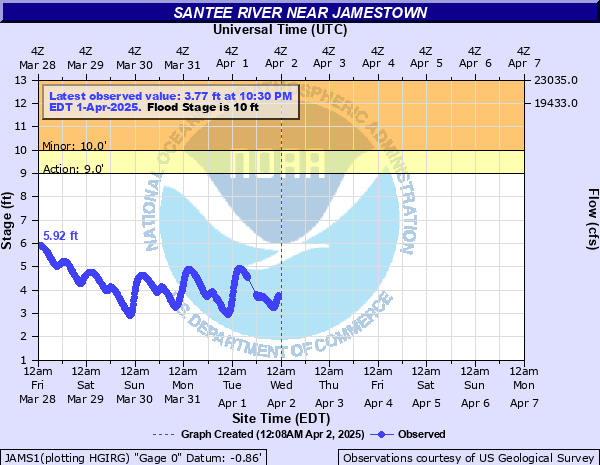
Critical Stages
9' - Action
10' - Flood
17' - Moderate
22' - Major
Latest Observation
Updated: 12:30 AM EST 12/15/25
Status: No Flooding
Stage: 1.24 ft
Flow: -999 kcfs
Forecast
Forecast not available for this location.
| Time | Stage (ft) | Flow (kcfs) |
|---|---|---|
| 12:30 AM 12/15 | 1.24 | -999 |
| 12:15 AM 12/15 | 1.25 | -999 |
| 12:00 AM 12/15 | 1.26 | -999 |
| 11:45 PM 12/14 | 1.28 | -999 |
| 11:30 PM 12/14 | 1.25 | -999 |
| 11:15 PM 12/14 | 1.29 | -999 |
| 11:00 PM 12/14 | 1.29 | -999 |
| 10:45 PM 12/14 | 1.33 | -999 |
| 10:30 PM 12/14 | 1.35 | -999 |
| 10:15 PM 12/14 | 1.35 | -999 |
| 10:00 PM 12/14 | 1.33 | -999 |
| 9:45 PM 12/14 | 1.34 | -999 |
| 9:30 PM 12/14 | 1.38 | -999 |
| 9:15 PM 12/14 | 1.38 | -999 |
| 9:00 PM 12/14 | 1.37 | -999 |
| 8:45 PM 12/14 | 1.35 | -999 |
| 8:30 PM 12/14 | 1.39 | -999 |
| 8:15 PM 12/14 | 1.39 | -999 |
| 8:00 PM 12/14 | 1.4 | -999 |
| 7:45 PM 12/14 | 1.43 | -999 |
| 7:30 PM 12/14 | 1.4 | -999 |
| 7:15 PM 12/14 | 1.41 | -999 |
| 7:00 PM 12/14 | 1.46 | -999 |
| 6:45 PM 12/14 | 1.49 | -999 |
| 6:30 PM 12/14 | 1.48 | -999 |
| 6:15 PM 12/14 | 1.38 | -999 |
| 6:00 PM 12/14 | 1.4 | -999 |
| 5:45 PM 12/14 | 1.38 | -999 |
| 5:30 PM 12/14 | 1.38 | -999 |
| 5:15 PM 12/14 | 1.38 | -999 |
24' -
water will start to enter the lower level of the home at the end of Lawton Farm Lane.
22' -
water will surround the residence at the end of Crow Hill Drive and portions of the road will be covered with water due to backwater effects. The lower three quarters of a mile of Corner Loop Road is flooded and a few homes will be impacted. Water will restrict access to Belleflower Way and Belladonna Court and approach a few homes in the Belleflower Plantation subdivision. The residence at the end of Lawton Farm Lane is also surrounded by water and the lower portion of Old Gate Lane is covered by water.
19' -
the lower quarter mile of Lawton Farm Lane is impassable.
18' -
the boat landing at the end of Santee Landing Road will be inaccessible. The lower half mile of Corner Loop Road will be impassable due to backwater effects from Pole Branch Creek. Water covers the lower quarter mile of Lawton Farm Lane.
17' -
the lower half mile of Harris Landing Road is flooded and impassable and the residence at the end of the road is flooded. Lenuds Ferry boat landing at Highway 41 is inaccessible and the parking lot is flooded.
16' -
water surrounds the residence at the end of Harris Landing Road and the adjacent boat ramp is inaccessible.
12' -
several dirt logging roads are impassable.
10' -
water covers numerous logging roads and inundates timber land adjacent to the river. Most access points to Wee Tee State Forest are cut off.
| Date | Stage (ft) |
|---|---|
| Jul 26, 1916 | 33 |
| Apr 15, 1936 | 32 |
| Aug 26, 1928 | 30 |
| Oct 10, 1929 | 29.8 |
| Oct 5, 2024 | 23.94 |
| Feb 14, 2020 | 23.37 |
| Mar 28, 2003 | 22.84 |
| Jan 6, 2016 | 22.82 |
| Sep 26, 1945 | 22.8 |
| Oct 10, 2015 | 22.13 |
| Mar 9, 1987 | 21.87 |
| Feb 10, 1998 | 21.67 |
| Mar 23, 1975 | 21.28 |
| Jan 18, 1993 | 20.81 |
| Nov 3, 1990 | 20.62 |
| Mar 1, 1995 | 20.61 |
| Mar 29, 1944 | 20.6 |
| Oct 24, 1964 | 20.5 |
| Feb 13, 2010 | 19.83 |
| Mar 6, 1979 | 19.67 |
Data provided by the National Weather Service.