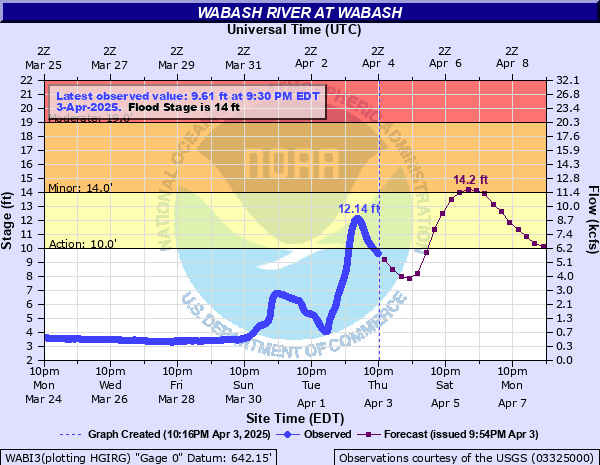
Wabash River at Wabash
Critical Stages
10' - Action
14' - Flood
19' - Moderate
23' - Major
Latest Observation
Updated: 9:30 PM EST 12/7/25
Status: No Flooding
Stage: 2.42 ft
Flow: 0.112 kcfs
Forecast
Forecast not available for this location.
| Time | Stage (ft) | Flow (kcfs) |
|---|---|---|
| 9:30 PM 12/7 | 2.42 | 0.112 |
| 9:15 PM 12/7 | 2.43 | 0.114 |
| 9:00 PM 12/7 | 2.42 | 0.112 |
| 8:45 PM 12/7 | 2.42 | 0.112 |
| 8:30 PM 12/7 | 2.43 | 0.114 |
| 8:15 PM 12/7 | 2.42 | 0.112 |
| 8:00 PM 12/7 | 2.43 | 0.114 |
| 7:45 PM 12/7 | 2.43 | 0.114 |
| 7:30 PM 12/7 | 2.41 | 0.109 |
| 7:15 PM 12/7 | 2.43 | 0.114 |
| 7:00 PM 12/7 | 2.43 | 0.114 |
| 6:45 PM 12/7 | 2.44 | 0.117 |
| 6:30 PM 12/7 | 2.38 | 0.102 |
| 6:15 PM 12/7 | 2.38 | 0.102 |
| 6:00 PM 12/7 | 2.39 | 0.105 |
| 5:45 PM 12/7 | 2.42 | 0.112 |
| 5:30 PM 12/7 | 2.44 | 0.117 |
| 5:15 PM 12/7 | 2.44 | 0.117 |
| 5:00 PM 12/7 | 2.43 | 0.114 |
| 4:45 PM 12/7 | 2.44 | 0.117 |
| 4:30 PM 12/7 | 2.42 | 0.112 |
| 4:15 PM 12/7 | 2.44 | 0.117 |
| 4:00 PM 12/7 | 2.44 | 0.117 |
| 3:45 PM 12/7 | 2.44 | 0.117 |
| 3:30 PM 12/7 | 2.44 | 0.117 |
| 3:15 PM 12/7 | 2.44 | 0.117 |
| 3:00 PM 12/7 | 2.44 | 0.117 |
| 2:45 PM 12/7 | 2.44 | 0.117 |
| 2:30 PM 12/7 | 2.44 | 0.117 |
| 2:15 PM 12/7 | 2.44 | 0.117 |
28' -
Devastation occurs in flood plain area of Wabash, Lagro, and Rich Valley. All bridges over the Wabash River are in jeopardy. Portions of Indiana 524, Business US 24, and public utility area are washed away.
26.4' -
Flood water begins to hit the bottom of the bridge at the gage site causing increased flooding upstream of the gage.
26' -
Commercial and industrial areas of Wabash south of Market Street on the right bank are seriously flooded. Flood waters are several feet deep in city streets. There are many evacuations.
23' -
A major flood is in progress in Lagro and Wabash. Many city streets are impassible. Water is 2 or more feet deep in residential and commercial areas. Flooding begins in Rich Valley.
21' -
Some evacuations of residences and flooding of commercial and industrial areas begin in Wabash and Lagro. Flooding of Business US 24 near Rich Valley and Indiana 524 near Largo begins.
19' -
Residential and some commercial flooding begins on the right bank in southwest sections of Wabash. Extensive rural flooding south of Rich Valley begins in western Wabash County.
17' -
Some low lying areas and lowest sections of Wabash and Lagro begin to flood.
14' -
Lowland flooding begins in rural Wabash County.
| Date | Stage (ft) |
|---|---|
| Mar 26, 1913 | 28.7 |
| Feb 11, 1959 | 24.44 |
| May 18, 1943 | 24.22 |
| Jan 4, 1950 | 23 |
| Jan 15, 1930 | 22.8 |
| Jun 13, 1958 | 22.46 |
| Feb 27, 1936 | 22.4 |
| Mar 14, 1925 | 22 |
| Apr 28, 1959 | 21.92 |
| Feb 15, 1950 | 21.4 |
| Apr 6, 1957 | 21.38 |
| Jan 16, 1937 | 21.3 |
| Mar 29, 1924 | 21.2 |
| Mar 13, 1939 | 21.1 |
| Apr 9, 1938 | 20.8 |
| Apr 19, 2013 | 20.68 |
| Dec 19, 1924 | 20.6 |
| Apr 8, 1926 | 20.6 |
| Apr 12, 1944 | 20.54 |
| May 12, 1943 | 20.5 |
Data provided by the National Weather Service.