Canadian River at Canadian
Critical Stages
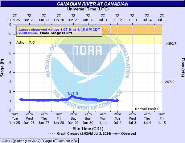
7' - Action
8' - Flood
10' - Moderate
20' - Major
Latest Observation
Updated: 4:45 PM CST 12/15/25
Status: No Flooding
Stage: 1.33 ft
Flow: 0.0393 kcfs
Forecast
Forecast not available for this location.
| Time | Stage (ft) | Flow (kcfs) |
|---|---|---|
| 4:45 PM 12/15 | 1.33 | 0.0393 |
| 4:30 PM 12/15 | 1.34 | 0.0405 |
| 4:15 PM 12/15 | 1.34 | 0.0405 |
| 4:00 PM 12/15 | 1.33 | 0.0393 |
| 3:45 PM 12/15 | 1.33 | 0.0393 |
| 3:30 PM 12/15 | 1.33 | 0.0393 |
| 3:15 PM 12/15 | 1.33 | 0.0393 |
| 3:00 PM 12/15 | 1.33 | 0.0393 |
| 2:45 PM 12/15 | 1.33 | 0.0393 |
| 2:30 PM 12/15 | 1.34 | 0.0405 |
| 2:15 PM 12/15 | 1.34 | 0.0405 |
| 2:00 PM 12/15 | 1.34 | 0.0405 |
| 1:45 PM 12/15 | 1.34 | 0.0405 |
| 1:30 PM 12/15 | 1.35 | 0.0416 |
| 1:15 PM 12/15 | 1.34 | 0.0405 |
| 1:00 PM 12/15 | 1.33 | 0.0393 |
| 12:45 PM 12/15 | 1.33 | 0.0393 |
| 12:30 PM 12/15 | 1.34 | 0.0405 |
| 12:15 PM 12/15 | 1.35 | 0.0416 |
| 12:00 PM 12/15 | 1.34 | 0.0405 |
| 11:45 AM 12/15 | 1.35 | 0.0416 |
| 11:30 AM 12/15 | 1.35 | 0.0416 |
| 11:15 AM 12/15 | 1.35 | 0.0416 |
| 11:00 AM 12/15 | 1.35 | 0.0416 |
| 10:45 AM 12/15 | 1.35 | 0.0416 |
| 10:30 AM 12/15 | 1.34 | 0.0405 |
| 10:15 AM 12/15 | 1.34 | 0.0405 |
| 10:00 AM 12/15 | 1.35 | 0.0416 |
| 9:45 AM 12/15 | 1.34 | 0.0405 |
| 9:30 AM 12/15 | 1.34 | 0.0405 |
20' -
Major flooding of farm and ranch land. Highway 83 bridge may be impassable due to overflow of highway approaches. Several structures along the north bank at Canadian are flooded.
10' -
Moderate overbank flooding of farm and ranch land occurs. Flooding of a few buildings along the left (north) bank near the gage is possible.
8' -
Minor overbank flooding of farm and ranch land occurs. No significant damage expected to occur.
| Date | Stage (ft) |
|---|---|
| Oct 2, 1904 | 20 |
| May 2, 1914 | 12 |
| Oct 5, 1923 | 12 |
| Jun 3, 1937 | 11.3 |
| May 18, 1977 | 9.84 |
| Apr 15, 1973 | 9.8 |
| Sep 23, 1941 | 9.8 |
| Jun 11, 1983 | 9.56 |
| May 28, 2015 | 9.53 |
| May 25, 1957 | 9.3 |
| Jun 28, 1955 | 9.25 |
| Aug 1, 1962 | 9.1 |
| Oct 1, 1941 | 8.98 |
| Jun 23, 2014 | 7.25 |
Data provided by the National Weather Service.