« Back to Wildhorse Golf Club At Robson Ranch Rivers
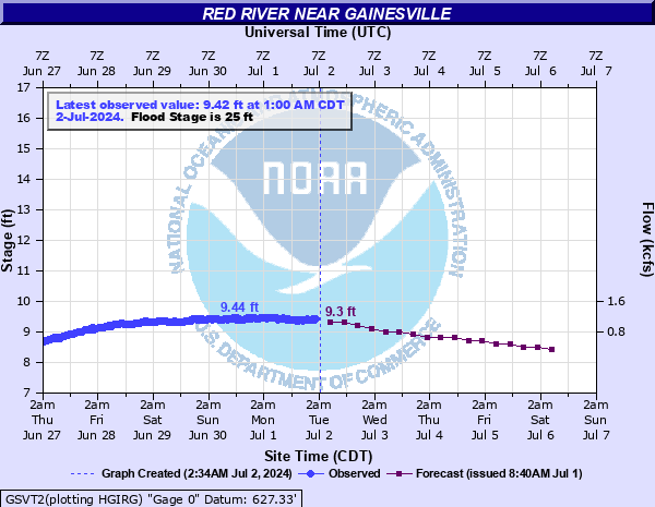
Red River near Gainesville
Critical Stages
22' - Action
25' - Flood
28' - Moderate
34' - Major
Latest Observation
Updated: 6:00 AM CST 12/6/25
Status: No Flooding
Stage: 5.05 ft
Flow: 0.159 kcfs
Forecast
| Time | Stage (ft) | Flow (kcfs) |
|---|---|---|
| 12 PM 12/6 | 5.1 | 0.177 |
| 6 PM 12/6 | 5.1 | 0.177 |
| 12 AM 12/7 | 5.1 | 0.177 |
| 6 AM 12/7 | 5.1 | 0.177 |
| 12 PM 12/7 | 5.1 | 0.177 |
| 6 PM 12/7 | 5.1 | 0.177 |
| 12 AM 12/8 | 5.1 | 0.177 |
| 6 AM 12/8 | 5.1 | 0.177 |
| 12 PM 12/8 | 5.1 | 0.177 |
| 6 PM 12/8 | 5.1 | 0.177 |
| 12 AM 12/9 | 5.1 | 0.177 |
| 6 AM 12/9 | 5.1 | 0.177 |
| 12 PM 12/9 | 5.1 | 0.177 |
| 6 PM 12/9 | 5.1 | 0.177 |
| 12 AM 12/10 | 5.1 | 0.177 |
| 6 AM 12/10 | 5.1 | 0.177 |
| Time | Stage (ft) | Flow (kcfs) |
|---|---|---|
| 6:00 AM 12/6 | 5.05 | 0.159 |
| 5:30 AM 12/6 | 5.05 | 0.159 |
| 5:00 AM 12/6 | 5.05 | 0.159 |
| 4:30 AM 12/6 | 5.05 | 0.159 |
| 4:00 AM 12/6 | 5.05 | 0.159 |
| 3:30 AM 12/6 | 5.04 | 0.155 |
| 3:00 AM 12/6 | 5.05 | 0.159 |
| 2:30 AM 12/6 | 5.05 | 0.159 |
| 2:00 AM 12/6 | 5.05 | 0.159 |
| 1:30 AM 12/6 | 5.05 | 0.159 |
| 1:00 AM 12/6 | 5.05 | 0.159 |
| 12:30 AM 12/6 | 5.05 | 0.159 |
| 12:00 AM 12/6 | 5.06 | 0.162 |
| 11:30 PM 12/5 | 5.06 | 0.162 |
| 11:00 PM 12/5 | 5.06 | 0.162 |
| 10:30 PM 12/5 | 5.06 | 0.162 |
| 10:00 PM 12/5 | 5.06 | 0.162 |
| 9:30 PM 12/5 | 5.06 | 0.162 |
| 9:00 PM 12/5 | 5.06 | 0.162 |
| 8:30 PM 12/5 | 5.06 | 0.162 |
| 8:00 PM 12/5 | 5.06 | 0.162 |
| 7:30 PM 12/5 | 5.07 | 0.166 |
| 7:00 PM 12/5 | 5.07 | 0.166 |
| 6:30 PM 12/5 | 5.07 | 0.166 |
| 6:00 PM 12/5 | 5.07 | 0.166 |
| 5:30 PM 12/5 | 5.07 | 0.166 |
| 5:00 PM 12/5 | 5.08 | 0.169 |
| 4:30 PM 12/5 | 5.08 | 0.169 |
| 4:00 PM 12/5 | 5.05 | 0.159 |
| 3:30 PM 12/5 | 5.09 | 0.173 |
43' -
Extensive flooding to depths of 18 feet occurs in agricultural lands... pecan groves... oil wells... and rural roads along and near the river in Love County in Oklahoma... and Cooke County in Texas. Sandpit operations are affected. Floodwaters reach the sides of the U.S. Interstate Highway I-35 Bridge about 1.5 feet higher than the low chord of the bridge. River levels are about 2 feet higher than the levels reached by the May 31...1987 flood crest.
42.5' -
Extensive flooding to depths of 17.5 feet occurs in agricultural lands... pecan groves... oil wells... and rural roads along and near the river in Love County in Oklahoma... and Cooke County in Texas. Sandpit operations are affected. Floodwaters reach the sides of the U.S. Interstate Highway I-35 Bridge about 1 foot higher than the low chord of the bridge. River levels are about 2.5 feet higher than the levels reached by the May 31...1987 flood crest.
42' -
Extensive flooding to depths of 17 feet occurs in agricultural lands... pecan groves... oil wells... and rural roads along and near the river in Love County in Oklahoma... and Cooke County in Texas. Sandpit operations are affected. Floodwaters reach the sides of the U.S. Interstate Highway I-35 Bridge about 0.5 feet higher than the low chord of the bridge. River levels are about 2 feet higher than the levels reached by the May 31...1987 flood crest.
41.5' -
Extensive flooding to depths of 16.5 feet occurs in agricultural lands... pecan groves... oil wells... and rural roads along and near the river in Love County in Oklahoma... and Cooke County in Texas. Sandpit operations are affected. Floodwaters reach the low chord of the U.S. Interstate Highway I-35 Bridge. River levels are about 1.5 feet higher than the levels reached by the May 31...1987 flood crest.
41' -
Extensive flooding to depths of 16 feet occurs in agricultural lands... pecan groves... oil wells... and rural roads along and near the river in Love County in Oklahoma... and Cooke County in Texas. Sandpit operations are affected. Floodwaters begin to approach the low chord of the U.S. Interstate Highway I-35 Bridge. River levels are about 1 foot higher than the levels reached by the May 31...1987 flood crest.
40' -
Extensive flooding of crop and range lands... pecan groves... oil wells... and rural roads occurs along the river in Love County in Oklahoma... and Cooke County in Texas. Sandpit operations are affected. Livestock and other property should be removed to places which are at least 15 feet higher than nearby river banks to avoid being stranded. Floodwaters match the levels reached by the May 31...1987 flood crest.
39' -
Crop and range lands... pecan groves... oil wells... and rural roads are flooded or isolated. Low-lying fields... upstream in western Love County in Oklahoma... and Cooke County in Texas... experience overflows several hours before the crest reaches the Interstate Highway I-35 crossing north of Gainesville. Sandpit operations are affected. Livestock and other property should be removed to places which are at least 14 feet higher than nearby river banks to avoid being stranded.
38' -
Crop and range lands... pecan groves... oil wells... and rural roads are flooded or isolated. Low-lying fields... upstream in western Love County in Oklahoma... and Cooke County in Texas... experience overflows several hours before the crest reaches the Interstate Highway I-35 crossing north of Gainesville. Sandpit operations are affected. Livestock and other property should be removed to places which are at least 13 feet higher than nearby river banks to avoid being stranded.
37' -
Crop and range lands... pecan groves... oil wells... and rural roads are flooded or isolated. Low-lying fields... upstream in western Love County in Oklahoma... and Cooke County in Texas... experience overflows several hours before the crest reaches the Interstate Highway I-35 crossing north of Gainesville. Sandpit operations are affected. Livestock and other property should be removed to places which are at least 12 feet higher than nearby river banks to avoid being stranded.
36' -
Crop and range lands... pecan groves... oil wells... and rural roads are flooded or isolated. Low-lying fields... upstream in western Love County in Oklahoma... and Cooke County in Texas... experience overflows several hours before the crest reaches the Interstate Highway I-35 crossing north of Gainesville. Sandpit operations are affected. Livestock and other property should be removed to places which are at least 11 feet higher than nearby river banks to avoid being stranded.
35' -
Crop and range lands... pecan groves... oil wells... and rural roads are flooded or isolated. Low-lying fields... upstream in western Love County in Oklahoma... and Cooke County in Texas... experience overflows several hours before the crest reaches the Interstate Highway I-35 crossing north of Gainesville. Sandpit operations are affected. Livestock and other property should be removed to places which are at least 10 feet higher than nearby river banks to avoid being stranded.
34' -
Crop and range lands... pecan groves... oil wells... and rural roads are flooded or isolated. Low-lying fields... upstream in western Love County in Oklahoma... and Cooke County in Texas... experience overflows several hours before the crest reaches the Interstate Highway I-35 crossing north of Gainesville. Sandpit operations are affected. Livestock and other property should be removed to places which are at least 9 feet higher than nearby river banks to avoid being stranded.
33' -
Crop and range lands... pecan groves... oil wells... and rural roads are flooded or isolated. Low-lying fields... upstream in western Love County in Oklahoma... and Cooke County in Texas... experience overflows several hours before the crest reaches the Interstate Highway I-35 crossing north of Gainesville. Sandpit operations are affected. Livestock and other property should be removed to places which are at least 8 feet higher than nearby river banks to avoid being stranded.
32' -
Crop and range lands... pecan groves... oil wells... and rural roads are flooded or isolated. Low-lying fields... upstream in western Love County in Oklahoma... and Cooke County in Texas... experience overflows several hours before the crest reaches the Interstate Highway I-35 crossing north of Gainesville. Sandpit operations are affected. Livestock and other property should be removed to places which are at least 7 feet higher than nearby river banks to avoid being stranded.
31' -
Crop and range lands... pecan groves... oil wells... and rural roads are flooded or isolated. Low-lying fields... upstream in western Love County in Oklahoma... and Cooke County in Texas... experience overflows several hours before the crest reaches the Interstate Highway I-35 crossing north of Gainesville. Sandpit operations are affected. Livestock and other property should be removed to places which are at least 6 feet higher than nearby river banks to avoid being stranded.
30' -
Crop and range lands... pecan groves... oil wells... and rural roads are flooded or isolated. Low-lying fields... upstream in western Love County in Oklahoma... and Cooke County in Texas... experience overflows several hours before the crest reaches the Interstate Highway I-35 crossing north of Gainesville. Sandpit operations are affected. Livestock and other property should be removed to places which are at least 5 feet higher than nearby river banks to avoid being stranded.
29' -
Crop and range lands... pecan groves... oil wells... and rural roads are flooded or isolated. Low-lying fields... upstream in western Love County in Oklahoma... and Cooke County in Texas... experience overflows several hours before the crest reaches the Interstate Highway I-35 crossing north of Gainesville. Sandpit operations are affected. Livestock and other property should be removed to places which are at least 4 feet higher than nearby river banks to avoid being stranded.
28' -
Crop and range lands... pecan groves... oil wells... and rural roads are flooded or isolated. Low-lying fields... upstream in western Love County in Oklahoma... and Cooke County in Texas... experience overflows several hours before the crest reaches the Interstate Highway I-35 crossing north of Gainesville. Sandpit operations are affected. Livestock and other property should be removed to places which are at least 3 feet higher than nearby river banks to avoid being stranded.
27' -
Crop and range lands... pecan groves... oil wells... and rural roads are flooded or isolated. Low-lying fields... upstream in western Love County in Oklahoma... and Cooke County in Texas... experience overflows several hours before the crest reaches the Interstate Highway I-35 crossing north of Gainesville. Sandpit operations are affected. Livestock and other property should be removed to places which are at least 2 feet higher than nearby river banks to avoid being stranded.
26' -
Crop and range lands... pecan groves... oil wells... and rural roads are flooded or isolated. Low-lying fields... upstream in western Love County in Oklahoma... and Cooke County in Texas... experience overflows several hours before the crest reaches the Interstate Highway I-35 crossing north of Gainesville. Sandpit operations are affected. Livestock and other property should be removed to places which are at least 1 foot higher than nearby river banks to avoid being stranded.
25' -
Crop and range lands... pecan groves... oil wells... and rural roads are flooded or isolated. Low-lying fields... upstream in western Love County in Oklahoma... and Cooke County in Texas... experience overflows several hours before the crest reaches the Interstate Highway I-35 crossing north of Gainesville. Sandpit operations are affected. Livestock and other property should be removed to places which are higher than nearby river banks to avoid being stranded.
24' -
Low-lying fields... upstream in western Love County in Oklahoma... and Cooke County in Texas... may experience shallow overflows several hours before the crest reaches the Interstate Highway I-35 crossing north of Gainesville. Sandpit operations may be affected. Livestock and other property should be removed to places which are higher than nearby river banks to avoid being stranded.
| Date | Stage (ft) |
|---|---|
| Jun 19, 2015 | 42.05 |
| May 31, 1987 | 40.08 |
| May 4, 2025 | 38.27 |
| Oct 24, 1983 | 37.1 |
| Jun 13, 1995 | 36.63 |
| Jun 9, 1995 | 36.03 |
| May 31, 2015 | 34.98 |
| May 22, 2015 | 34.52 |
| May 5, 1990 | 33.13 |
| May 11, 2015 | 31.69 |
| Apr 21, 2016 | 31.08 |
| May 11, 1993 | 30.99 |
| Jul 3, 2007 | 30.58 |
| Aug 6, 1995 | 29.65 |
| Mar 19, 1998 | 29.62 |
| Oct 14, 1981 | 29.45 |
| Apr 27, 1990 | 28.85 |
| Dec 23, 1991 | 28.69 |
| May 20, 2015 | 28.5 |
| May 26, 2016 | 27.3 |
Data provided by the National Weather Service.