Talkeetna River at Alaska Railroad Bridge 227.1 at Talkeetna
Critical Stages
12' - Action
13' - Flood
14' - Moderate
15' - Major
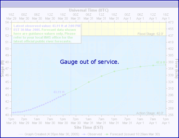
Latest Observation
Updated: 2:00 PM LMT 1/1/01
Status: Out Of Service
Stage: -999 ft
Flow: -999 kcfs
Forecast
Forecast not available for this location.
Observation history not available.
15.5' -
2012 peak flood - major flooding in East Talkeetna
14' -
Water can flow into Beaver Road and F Street in NE Talkeetna
13' -
High water during the summer floods of 2003; water flowed into the low lying areas near the end of the dike at the Talkeetna River.
10' -
Water in low lying areas west of Main Street. Summer 2020 - Erosion at the confluence of the Talkeetna and Susitna Rivers.
9.69' -
High water level -- Class IV+ whitewater in Talkeetna River canyon
8.19' -
Medium water level -- Class IV whitewater in Talkeetna River canyon
6.2' -
Low water level -- Class IV- whitewater in Talkeetna River canyon
| Date | Stage (ft) |
|---|---|
| Oct 11, 1986 | 16.55 |
| Sep 21, 2012 | 15.65 |
| Aug 19, 2006 | 13.82 |
| Aug 2, 1981 | 13.3 |
| Jul 28, 1980 | 12.7 |
| Jul 16, 1979 | 12.7 |
| Jun 2, 2013 | 12.48 |
| Aug 25, 1984 | 12.15 |
| Jul 31, 1987 | 11.75 |
| Jun 8, 1998 | 11.7 |
| Sep 14, 1990 | 11.57 |
| Aug 13, 1999 | 11.5 |
| Jul 26, 1982 | 11.5 |
| Aug 28, 2021 | 11.48 |
| Sep 13, 2016 | 11.44 |
| Jul 28, 2003 | 11.34 |
| Jun 26, 2014 | 11.14 |
| Sep 29, 2015 | 11.07 |
| Jun 15, 1989 | 11.02 |
| Sep 15, 1985 | 10.99 |
Data provided by the National Weather Service.