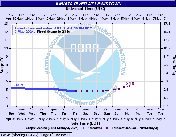
Juniata River at Lewistown
Critical Stages
18' - Action
23' - Flood
27' - Moderate
28' - Major
Latest Observation
Updated: 9:30 AM EST 12/8/25
Status: No Flooding
Stage: 3.24 ft
Flow: 0.79 kcfs
Forecast
| Time | Stage (ft) | Flow (kcfs) |
|---|---|---|
| 1 PM 12/8 | 3.2 | 0.762 |
| 7 PM 12/8 | 3.2 | 0.762 |
| 1 AM 12/9 | 3.2 | 0.762 |
| 7 AM 12/9 | 3.2 | 0.762 |
| 1 PM 12/9 | 3.2 | 0.762 |
| 7 PM 12/9 | 3.2 | 0.762 |
| 1 AM 12/10 | 3.2 | 0.762 |
| 7 AM 12/10 | 3.2 | 0.762 |
| 1 PM 12/10 | 3.2 | 0.762 |
| 7 PM 12/10 | 3.2 | 0.762 |
| 1 AM 12/11 | 3.3 | 0.834 |
| 7 AM 12/11 | 3.3 | 0.834 |
| Time | Stage (ft) | Flow (kcfs) |
|---|---|---|
| 9:30 AM 12/8 | 3.24 | 0.79 |
| 9:00 AM 12/8 | 3.24 | 0.79 |
| 8:30 AM 12/8 | 3.24 | 0.79 |
| 8:00 AM 12/8 | 3.24 | 0.79 |
| 7:30 AM 12/8 | 3.24 | 0.79 |
| 7:00 AM 12/8 | 3.24 | 0.79 |
| 6:30 AM 12/8 | 3.24 | 0.79 |
| 6:00 AM 12/8 | 3.24 | 0.79 |
| 5:30 AM 12/8 | 3.24 | 0.79 |
| 5:02 AM 12/8 | 3.24 | 0.79 |
| 5:00 AM 12/8 | 3.24 | 0.79 |
| 4:30 AM 12/8 | 3.24 | 0.79 |
| 4:00 AM 12/8 | 3.24 | 0.79 |
| 3:30 AM 12/8 | 3.24 | 0.79 |
| 3:00 AM 12/8 | 3.24 | 0.79 |
| 2:30 AM 12/8 | 3.24 | 0.79 |
| 2:00 AM 12/8 | 3.24 | 0.79 |
| 1:30 AM 12/8 | 3.24 | 0.79 |
| 1:00 AM 12/8 | 3.24 | 0.79 |
| 12:30 AM 12/8 | 3.24 | 0.79 |
| 12:00 AM 12/8 | 3.24 | 0.79 |
| 11:30 PM 12/7 | 3.24 | 0.79 |
| 11:00 PM 12/7 | 3.24 | 0.79 |
| 10:30 PM 12/7 | 3.24 | 0.79 |
| 10:00 PM 12/7 | 3.24 | 0.79 |
| 9:30 PM 12/7 | 3.24 | 0.79 |
| 9:00 PM 12/7 | 3.24 | 0.79 |
| 8:30 PM 12/7 | 3.24 | 0.79 |
| 8:00 PM 12/7 | 3.24 | 0.79 |
| 7:30 PM 12/7 | 3.24 | 0.79 |
43.3' -
Flood of record from June 1889. FEMA 0.2 0X0P+0nnual Chance Flood Level (500-year flood).
34.5' -
FEMA 1 0X0P+0nnual Chance Flood Level (100-year flood). Widespread inundation occurs on both banks of the river. A large portion of Lewistown is affected by flood waters.
32' -
The right, or south bank begins to overflow. Expect water up to 6 feet deep in houses on West Elizabeth Street. Expect water up to 2 feet deep in houses on South Main Street.
31' -
FEMA 2 0X0P+0nnual Chance Flood Level (50-year flood).
30' -
Widespread inundation occurs in and around Lewistown. Water reaches South Main Street.
28' -
Considerable flood damage occurs to homes and businesses in and around lewistown.
27' -
Several homes on West Elizabeth Street will flood. Route 22 is also affected.
25' -
Basement flooding occurs in the low lying areas adjacent to the river and Kishacoquillas creek. Athletic fields will be inundated.
24.5' -
FEMA 10 0X0P+0nnual Chance Flood Level (10-year flood).
23' -
Basements of a few homes in the lowest lying areas will flood. Backwater on Kishacoquillas Creek will affect the athletic fields.
| Date | Stage (ft) |
|---|---|
| Jun 1, 1889 | 43.3 |
| Mar 18, 1936 | 43 |
| Jun 23, 1972 | 42.1 |
| Nov 26, 1950 | 32 |
| Sep 19, 2004 | 31.68 |
| Jan 20, 1996 | 31.629999160767 |
| Feb 15, 1984 | 27.4 |
| Nov 8, 1997 | 23.6 |
| Apr 3, 1970 | 23.3 |
| Sep 11, 2018 | 23 |
| Nov 29, 1993 | 22.4 |
| Mar 26, 1994 | 21.34 |
| Feb 23, 1971 | 19.8 |
Data provided by the National Weather Service.