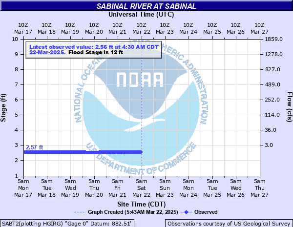
Sabinal River at Sabinal
Critical Stages
10' - Action
12' - Flood
16' - Moderate
24' - Major
Latest Observation
Updated: 2:30 AM CST 12/16/25
Status: No Flooding
Stage: 2.79 ft
Flow: 0.0012 kcfs
Forecast
Forecast not available for this location.
| Time | Stage (ft) | Flow (kcfs) |
|---|---|---|
| 2:30 AM 12/16 | 2.79 | 0.0012 |
| 2:15 AM 12/16 | 2.79 | 0.0012 |
| 2:00 AM 12/16 | 2.79 | 0.0012 |
| 1:45 AM 12/16 | 2.79 | 0.0012 |
| 1:30 AM 12/16 | 2.79 | 0.0012 |
| 1:15 AM 12/16 | 2.79 | 0.0012 |
| 1:00 AM 12/16 | 2.79 | 0.0012 |
| 12:45 AM 12/16 | 2.79 | 0.0012 |
| 12:30 AM 12/16 | 2.79 | 0.0012 |
| 12:15 AM 12/16 | 2.79 | 0.0012 |
| 12:00 AM 12/16 | 2.79 | 0.0012 |
| 11:45 PM 12/15 | 2.79 | 0.0012 |
| 11:30 PM 12/15 | 2.79 | 0.0012 |
| 11:15 PM 12/15 | 2.79 | 0.0012 |
| 11:00 PM 12/15 | 2.79 | 0.0012 |
| 10:45 PM 12/15 | 2.79 | 0.0012 |
| 10:30 PM 12/15 | 2.79 | 0.0012 |
| 10:15 PM 12/15 | 2.79 | 0.0012 |
| 10:00 PM 12/15 | 2.79 | 0.0012 |
| 9:45 PM 12/15 | 2.79 | 0.0012 |
| 9:30 PM 12/15 | 2.79 | 0.0012 |
| 9:15 PM 12/15 | 2.79 | 0.0012 |
| 9:00 PM 12/15 | 2.79 | 0.0012 |
| 8:45 PM 12/15 | 2.79 | 0.0012 |
| 8:30 PM 12/15 | 2.79 | 0.0012 |
| 8:15 PM 12/15 | 2.79 | 0.0012 |
| 8:00 PM 12/15 | 2.79 | 0.0012 |
| 7:45 PM 12/15 | 2.79 | 0.0012 |
| 7:30 PM 12/15 | 2.79 | 0.0012 |
| 7:15 PM 12/15 | 2.79 | 0.0012 |
32' -
Disastrous flooding upstream near Utopia puts flow four feet deep in the "Utopia on the River" camp headquarters washing autos from the parking lot and threatening lives. Camping sites at a girl scout camp three miles south of Utopia are dangerously flooded. Secondary and primary roads and low bridges near the river flood under several feet of fast moving water as the flood wave moves from the headwaters to the Frio River confluence.
28' -
Major flooding threatens the "Utopia on the River" resort near Utopia. Numerous roads, crossings, and bridges are flooded severely. Livestock should be moved from vulnerable areas of the flood plain.
24' -
Major lowland flooding from the headwaters to the Frio River confluence. Very dangerous to campers upstream near Utopia. Many secondary and primary roads and low bridges are flooded and dangerous.
20' -
Lowland flooding damages crops and floods pastureland cutting off and potentially drowning livestock in low areas of the flood plain. Secondary roads and low bridges flood severely as the flood wave passes downstream.
16' -
Moderate lowland flooding inundates lowest secondary roads and bridges in the flood plain from the headwaters to the Frio River confluence.
12' -
Minor lowland flooding impacts lowest secondary roads, crossings and low bridges.
10' -
Flow extends into lowest areas of the flood plain with no significant damage.
| Date | Stage (ft) |
|---|---|
| Aug 24, 1919 | 40 |
| Jul 5, 2002 | 38.28 |
| Jun 17, 1958 | 33.3 |
| Jul 2, 1932 | 31 |
| Jul 21, 2007 | 27.14 |
| May 29, 1987 | 26.61 |
| Oct 13, 1981 | 21.14 |
| May 24, 2015 | 19.51 |
| Dec 31, 1984 | 19.1 |
| Oct 19, 1985 | 18.61 |
| Jun 9, 1992 | 17.36 |
| Dec 21, 1991 | 17.33 |
| Jul 18, 1990 | 16.24 |
| Oct 10, 2018 | 15.34 |
| Oct 28, 1996 | 14.08 |
| May 29, 2016 | 11.88 |
Data provided by the National Weather Service.