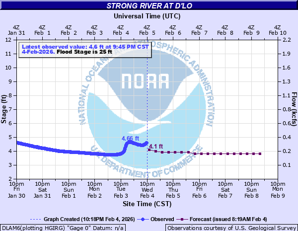
Strong River at D'lo
Critical Stages
24' - Action
25' - Flood
30' - Moderate
33' - Major
Latest Observation
Updated: 4:45 AM CST 12/13/25
Status: No Flooding
Stage: 3.03 ft
Flow: 0.0762 kcfs
Forecast
| Time | Stage (ft) | Flow (kcfs) |
|---|---|---|
| 12 PM 12/13 | 3 | 0.069 |
| 6 PM 12/13 | 3 | 0.069 |
| 12 AM 12/14 | 3 | 0.069 |
| 6 AM 12/14 | 3 | 0.069 |
| 12 PM 12/14 | 3 | 0.069 |
| 6 PM 12/14 | 2.9 | 0.0494 |
| 12 AM 12/15 | 2.9 | 0.0494 |
| 6 AM 12/15 | 2.9 | 0.0494 |
| 12 PM 12/15 | 2.9 | 0.0494 |
| 6 PM 12/15 | 2.9 | 0.0494 |
| 12 AM 12/16 | 2.9 | 0.0494 |
| 6 AM 12/16 | 2.9 | 0.0494 |
| 12 PM 12/16 | 2.9 | 0.0494 |
| 6 PM 12/16 | 2.9 | 0.0494 |
| 12 AM 12/17 | 2.8 | 0.0349 |
| 6 AM 12/17 | 2.8 | 0.0349 |
| Time | Stage (ft) | Flow (kcfs) |
|---|---|---|
| 5:45 AM 12/13 | 3.03 | 0.0762 |
| 5:30 AM 12/13 | 3.03 | 0.0762 |
| 5:15 AM 12/13 | 3.03 | 0.0762 |
| 5:00 AM 12/13 | 3.03 | 0.0762 |
| 4:45 AM 12/13 | 3.03 | 0.0762 |
| 4:30 AM 12/13 | 3.03 | 0.0762 |
| 4:15 AM 12/13 | 3.03 | 0.0762 |
| 4:00 AM 12/13 | 3.03 | 0.0762 |
| 3:45 AM 12/13 | 3.04 | 0.0787 |
| 3:30 AM 12/13 | 3.04 | 0.0787 |
| 3:15 AM 12/13 | 3.04 | 0.0787 |
| 3:00 AM 12/13 | 3.04 | 0.0787 |
| 2:45 AM 12/13 | 3.04 | 0.0787 |
| 2:30 AM 12/13 | 3.04 | 0.0787 |
| 2:15 AM 12/13 | 3.04 | 0.0787 |
| 2:00 AM 12/13 | 3.04 | 0.0787 |
| 1:45 AM 12/13 | 3.04 | 0.0787 |
| 1:30 AM 12/13 | 3.04 | 0.0787 |
| 1:15 AM 12/13 | 3.04 | 0.0787 |
| 1:00 AM 12/13 | 3.04 | 0.0787 |
| 12:45 AM 12/13 | 3.04 | 0.0787 |
| 12:30 AM 12/13 | 3.04 | 0.0787 |
| 12:15 AM 12/13 | 3.05 | 0.0813 |
| 12:00 AM 12/13 | 3.05 | 0.0813 |
| 11:45 PM 12/12 | 3.05 | 0.0813 |
| 11:30 PM 12/12 | 3.05 | 0.0813 |
| 11:15 PM 12/12 | 3.05 | 0.0813 |
| 11:00 PM 12/12 | 3.05 | 0.0813 |
| 10:45 PM 12/12 | 3.05 | 0.0813 |
| 10:30 PM 12/12 | 3.05 | 0.0813 |
38.2' -
Water reaches the floor of Old Highway 49 bridge.
37.5' -
Water reaches the river gage equipment shelf in the gage house next to the Old Highway 49 bridge.
35' -
Water reaches the underclearance of Old Highway 49 bridge.
33.4' -
Water floods homes in D'lo and Mendenhall and begins to flow over new Highway 49 bridge near D'lo.
32' -
Lower camping areas in the rv section of the Dlo Water Park begins to flood.
30' -
Major overbank flooding begins and several thousand acres of farmland become inundated.
28' -
Tent camping area of the Dlo Water Park is completely inundated.
27' -
Water floods entrance to lower tent camping area at the Dlo Water Park.
26' -
Water begins to inundate farmland along the river. Farmers should take necessary action to protect live stock and remove farm equipment.
25' -
Water begins backing up into Sellers Creek in Mendenhall.
19' -
Overbank flooding begins to occur within 200 feet of the channel.
| Date | Stage (ft) |
|---|---|
| Apr 8, 2014 | 34.31 |
| Apr 7, 1983 | 33.48 |
| Jan 7, 1950 | 33 |
| Apr 14, 1974 | 32.75 |
| Apr 13, 1980 | 32.65 |
| Feb 23, 2003 | 31.32 |
| Mar 28, 2009 | 31.18 |
| Apr 13, 1955 | 31.07 |
| Aug 26, 2022 | 30.78 |
| Feb 16, 1990 | 30.5 |
| Feb 7, 2004 | 30.29 |
| Feb 7, 2004 | 30.29 |
| Nov 29, 1948 | 30.02 |
| Apr 29, 1997 | 29.7 |
| Dec 26, 1974 | 29.6 |
| Mar 31, 1961 | 29.52 |
| Apr 1, 1976 | 29.46 |
| Mar 1, 1987 | 29.38 |
| May 1, 1991 | 29.17 |
| May 1, 1940 | 29.07 |
Data provided by the National Weather Service.