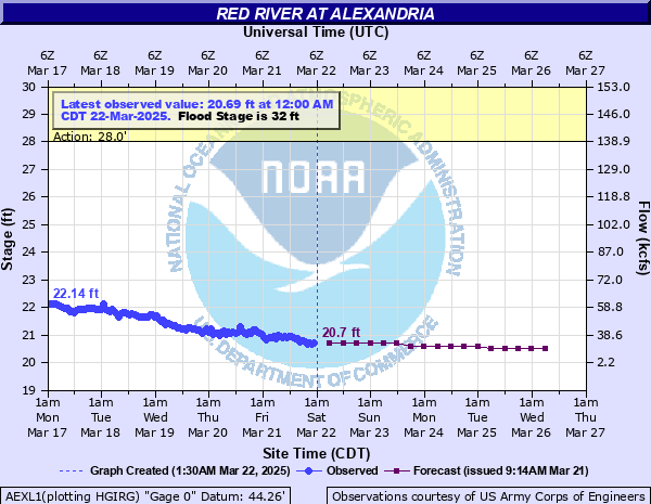
Red River at Alexandria
Critical Stages
28' - Action
32' - Flood
36' - Moderate
40' - Major
Latest Observation
Updated: 4:00 PM CST 12/15/25
Status: No Flooding
Stage: 20.33 ft
Flow: 13.1 kcfs
Forecast
| Time | Stage (ft) | Flow (kcfs) |
|---|---|---|
| 6 PM 12/15 | 20.3 | 12.1 |
| 12 AM 12/16 | 20.3 | 12.1 |
| 6 AM 12/16 | 20.3 | 12.1 |
| 12 PM 12/16 | 20.3 | 12.1 |
| 6 PM 12/16 | 20.3 | 12.1 |
| 12 AM 12/17 | 20.3 | 12.1 |
| 6 AM 12/17 | 20.3 | 12.1 |
| 12 PM 12/17 | 20.3 | 12.1 |
| 6 PM 12/17 | 20.3 | 12.1 |
| 12 AM 12/18 | 20.3 | 12.1 |
| 6 AM 12/18 | 20.3 | 12.1 |
| 12 PM 12/18 | 20.3 | 12.1 |
| 6 PM 12/18 | 20.3 | 12.1 |
| 12 AM 12/19 | 20.3 | 12.1 |
| 6 AM 12/19 | 20.3 | 12.1 |
| 12 PM 12/19 | 20.3 | 12.1 |
| 6 PM 12/19 | 20.3 | 12.1 |
| 12 AM 12/20 | 20.3 | 12.1 |
| 6 AM 12/20 | 20.3 | 12.1 |
| Time | Stage (ft) | Flow (kcfs) |
|---|---|---|
| 4:00 PM 12/15 | 20.33 | 13.1 |
| 3:00 PM 12/15 | 20.23 | 9.2 |
| 2:00 PM 12/15 | 20.34 | 13.5 |
| 1:00 PM 12/15 | 20.52 | 21.3 |
| 12:00 PM 12/15 | 20.53 | 21.8 |
| 11:00 AM 12/15 | 20.28 | 11.4 |
| 10:00 AM 12/15 | 20.36 | 14.3 |
| 9:00 AM 12/15 | 20.49 | 20 |
| 8:00 AM 12/15 | 20.35 | 13.9 |
| 7:00 AM 12/15 | 20.4 | 15.9 |
| 6:00 AM 12/15 | 20.45 | 18.3 |
| 5:00 AM 12/15 | 20.52 | 21.3 |
| 4:00 AM 12/15 | 20.35 | 13.9 |
| 3:00 AM 12/15 | 20.5 | 20.4 |
| 2:00 AM 12/15 | 20.32 | 12.8 |
| 1:00 AM 12/15 | 20.34 | 13.5 |
| 12:00 AM 12/15 | 20.56 | 23.1 |
| 11:00 PM 12/14 | 20.61 | 24.9 |
| 10:00 PM 12/14 | 20.6 | 24.6 |
| 9:00 PM 12/14 | 20.13 | 4.75 |
| 8:00 PM 12/14 | 20.19 | 7.07 |
| 7:00 PM 12/14 | 20.24 | 9.83 |
| 6:00 PM 12/14 | 20.3 | 12.1 |
| 5:00 PM 12/14 | 20.35 | 13.9 |
| 4:00 PM 12/14 | 20.35 | 13.9 |
| 3:00 PM 12/14 | 20.36 | 14.3 |
| 2:00 PM 12/14 | 20.37 | 14.7 |
| 1:00 PM 12/14 | 20.36 | 14.3 |
| 12:00 PM 12/14 | 20.35 | 13.9 |
| 11:00 AM 12/14 | 20.38 | 15.1 |
45.23' -
The river is at its flood of record. Catastrophic flood damage will occur.
44' -
Approximate top of levees in Alexandria. Water reaches low point of steel on us 167 bridge. Widespread major river and backwater flooding occurs.
40' -
Extensive backwater flooding occurs near the confluence of the Cane River.
37.5' -
Water reaches top of the rails of the Union Pacific railroad bridge at Boyce. Considerable backwater flooding will occur.
35' -
Considerable overflow below Alexandria to the confluence with the Black River occurs. Backwater flooding worsens along inflow bayous that drain into the Red River.
33' -
Backwater flooding begins along Bayou Maria and Huffman Creeks east of Pineville.
32' -
Flooding of lowland areas near the river occurs and recreational boating is affected.
31' -
Some of the outfall canals are slowed or not allowed to drain into the river between 31 and 32 feet. Depending on rainfall this could cause flooding along some of the bayous, especially along Bayou Rigolette.
28' -
Overflow occurs on floodway side of levee from gauge to Acme. Recreational boaters should use extreme caution due to high river flows.
23' -
When the river reaches 23 feet with a predicted continual rise, the public boat ramps in Rapides and Avoyelles parishes will close. These include the ramps at Boyce, Fort Buhlow, Alexandria Levee Park, Lock and Dam #2, Brouillette and Ben Routh recreation areas.
| Date | Stage (ft) |
|---|---|
| Apr 17, 1945 | 45.23 |
| Feb 5, 1932 | 43.65 |
| May 8, 1927 | 42.35 |
| May 19, 1953 | 42.05 |
| Jul 6, 1908 | 41.84 |
| Jun 4, 1935 | 41.22 |
| Jun 3, 1930 | 41.2 |
| May 7, 1957 | 40.7 |
| May 9, 1942 | 40.65 |
| May 12, 1958 | 40.18 |
| Mar 5, 1938 | 39.77 |
| May 20, 1990 | 39.3 |
| May 14, 1944 | 38.51 |
| Mar 19, 2016 | 38.32 |
| Jun 13, 1992 | 38.25 |
| Jun 12, 1892 | 38.25 |
| May 15, 1941 | 38.04 |
| Feb 21, 1950 | 38 |
| May 10, 1922 | 37.4 |
| Jun 2, 1920 | 37.15 |
Data provided by the National Weather Service.