|
|
| Temp (Air): | 57.9°F |
| Dew Point: | 55.0°F |
| Winds: | 4 knots W (280 deg true) |
| Pressure: | 30.01 in |
|
|
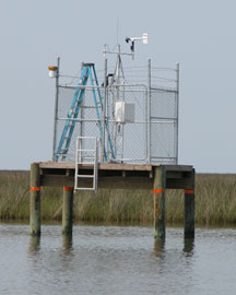
| Owned and maintained by: | National Estuarine Research Reserve System |
| Station Lat, Lon: | 30.36N, 88.42W |
| Buoy type: | NERRS Weather Station |
| Station elevation: | 0.5 m above mean sea level |
| Anemometer height: | 5 m above site elevation |
|
 |
| A marine forecast is not available for this station. |
12/10/2025
7:45pm | 57.9° | - | 55.0° | 4 kts W (280°) | 30.01 | - | - | - | - | 12/10/2025
7:30pm | 58.3° | - | 55.0° | 3 kts W (280°) | 30.01 | - | - | - | - | 12/10/2025
7:15pm | 59.0° | - | 55.8° | 5 kts W (280°) | 30.01 | - | - | - | - | 12/10/2025
7:00pm | 59.5° | - | 56.3° | 5 kts W (270°) | 30.01 | - | - | - | - | 12/10/2025
6:45pm | 59.4° | - | 56.1° | 4 kts WSW (260°) | 30.01 | - | - | - | - | 12/10/2025
6:30pm | 59.4° | - | 56.5° | 5 kts WSW (250°) | 29.98 | - | - | - | - | 12/10/2025
6:15pm | 59.4° | - | 56.5° | 6 kts WSW (240°) | 29.98 | - | - | - | - | 12/10/2025
6:00pm | 59.7° | - | 56.5° | 6 kts SW (230°) | 29.98 | - | - | - | - | 12/10/2025
5:45pm | 59.7° | - | 56.5° | 6 kts WSW (240°) | 29.98 | - | - | - | - | 12/10/2025
5:30pm | 59.7° | - | 56.5° | 7 kts SW (230°) | 29.95 | - | - | - | - | 12/10/2025
5:15pm | 59.7° | - | 56.5° | 6 kts SW (230°) | 29.95 | - | - | - | - | 12/10/2025
5:00pm | 59.7° | - | 56.3° | 6 kts SW (230°) | 29.95 | - | - | - | - | 12/10/2025
4:45pm | 59.9° | - | 56.1° | 5 kts SW (230°) | 29.95 | - | - | - | - | 12/10/2025
4:30pm | 60.6° | - | 56.1° | 6 kts SW (220°) | 29.95 | - | - | - | - | 12/10/2025
4:15pm | 61.2° | - | 55.8° | 6 kts SW (230°) | 29.95 | - | - | - | - | 12/10/2025
4:00pm | 61.7° | - | 55.6° | 7 kts SW (230°) | 29.95 | - | - | - | - | 12/10/2025
3:45pm | 61.7° | - | 55.2° | 8 kts SW (220°) | 29.95 | - | - | - | - | 12/10/2025
3:30pm | 61.9° | - | 55.4° | 8 kts SW (220°) | 29.95 | - | - | - | - | 12/10/2025
3:15pm | 61.7° | - | 55.6° | 8 kts SW (220°) | 29.95 | - | - | - | - | 12/10/2025
3:00pm | 60.8° | - | 55.4° | 8 kts SW (210°) | 29.95 | - | - | - | - | 12/10/2025
2:45pm | 60.4° | - | 55.6° | 7 kts SSW (200°) | 29.95 | - | - | - | - | 12/10/2025
2:30pm | 60.4° | - | 55.4° | 7 kts SSW (200°) | 29.95 | - | - | - | - | 12/10/2025
2:15pm | 60.8° | - | 54.7° | 7 kts SSW (200°) | 29.95 | - | - | - | - | 12/10/2025
2:00pm | 61.0° | - | 54.1° | 7 kts SW (210°) | 29.95 | - | - | - | - | 12/10/2025
1:45pm | 60.6° | - | 53.8° | 7 kts SSW (200°) | 29.98 | - | - | - | - |
| A detailed wave summary is not available for this station. |
| The latest Satellite Wind Map is unavailable for this location. |
| GDXM6 | 30.36N | 88.42W | Crooked Bayou, Grand Bay Reserve, MS |
| GBCM6 | 30.38N | 88.44W | Bayou Cumbest, Grand Bay Reserve, MS |
| GDQM6 | 30.36N | 88.46W | Bangs Lake, Grand Bay Reserve, MS |
| GBRM6 | 30.41N | 88.40W | Grand Bay NERR, Mississippi Sound, MS |
| GBHM6 | 30.42N | 88.41W | Bayou Heron, Grand Bay Reserve, MS |
| ULAM6 | 30.35N | 88.50W | 8741041 - Dock E. Port of Pascagoula, MS |
| RARM6 | 30.34N | 88.51W | 8741094 - Range A Rear, Port of Pascagoula, MS |
| PNLM6 | 30.37N | 88.56W | 8741533 - Pascagoula NOAA Lab, MS |
| DKCM6 | 30.36N | 88.57W | 8741501 - Dock C, Port of Pascagoula, MS |
| PTBM6 | 30.21N | 88.50W | 8741003 - Petit Bois Island, Port of Pascagoula, MS |
| KATA1 | 30.26N | 88.21W | Katrina Cut, AL |
| CRTA1 | 30.31N | 88.14W | Cedar Point, AL |
| DPHA1 | 30.25N | 88.08W | Dauphin Island Sea Lab, AL |
| DPIA1 | 30.25N | 88.08W | Dauphin Island, AL |
| DILA1 | 30.25N | 88.08W | 8735180 - Dauphin Island, AL |
Data provided by National Data Buoy Center
|

|