« Back to Carroll County Rivers
Duck River near Hurricane Mills
Critical Stages
16' - Action
20' - Flood
24' - Moderate
28' - Major
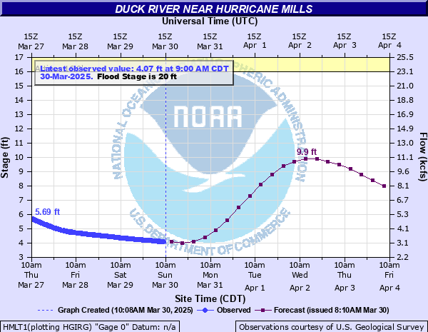
Latest Observation
Updated: 11:00 PM CST 12/4/25
Status: No Flooding
Stage: 5.12 ft
Flow: 4.24 kcfs
Forecast
| Time | Stage (ft) | Flow (kcfs) |
|---|---|---|
| 6 AM 12/5 | 5 | 4.1 |
| 12 PM 12/5 | 4.9 | 4 |
| 6 PM 12/5 | 4.7 | 3.8 |
| 12 AM 12/6 | 4.6 | 3.69 |
| 6 AM 12/6 | 4.4 | 3.49 |
| 12 PM 12/6 | 4.2 | 3.3 |
| 6 PM 12/6 | 4 | 3.1 |
| 12 AM 12/7 | 3.9 | 3.01 |
| 6 AM 12/7 | 3.7 | 2.82 |
| 12 PM 12/7 | 3.5 | 2.63 |
| 6 PM 12/7 | 3.4 | 2.54 |
| 12 AM 12/8 | 3.3 | 2.45 |
| 6 AM 12/8 | 3.1 | 2.26 |
| 12 PM 12/8 | 3 | 2.18 |
| 6 PM 12/8 | 2.9 | 2.1 |
| 12 AM 12/9 | 2.8 | 2.02 |
| 6 AM 12/9 | 2.8 | 2.02 |
| Time | Stage (ft) | Flow (kcfs) |
|---|---|---|
| 11:00 PM 12/4 | 5.12 | 4.24 |
| 10:45 PM 12/4 | 5.11 | 4.23 |
| 10:30 PM 12/4 | 5.12 | 4.24 |
| 10:15 PM 12/4 | 5.1 | 4.22 |
| 10:00 PM 12/4 | 5.09 | 4.21 |
| 9:45 PM 12/4 | 5.09 | 4.21 |
| 9:30 PM 12/4 | 5.08 | 4.2 |
| 9:15 PM 12/4 | 5.07 | 4.18 |
| 9:00 PM 12/4 | 5.05 | 4.16 |
| 8:45 PM 12/4 | 5.04 | 4.15 |
| 8:30 PM 12/4 | 5.04 | 4.15 |
| 8:15 PM 12/4 | 5.03 | 4.14 |
| 8:00 PM 12/4 | 5.01 | 4.11 |
| 7:45 PM 12/4 | 5.01 | 4.11 |
| 7:30 PM 12/4 | 4.99 | 4.09 |
| 7:15 PM 12/4 | 4.98 | 4.08 |
| 7:00 PM 12/4 | 4.96 | 4.06 |
| 6:45 PM 12/4 | 4.95 | 4.05 |
| 6:30 PM 12/4 | 4.93 | 4.03 |
| 6:15 PM 12/4 | 4.92 | 4.02 |
| 6:00 PM 12/4 | 4.9 | 4 |
| 5:45 PM 12/4 | 4.88 | 3.98 |
| 5:30 PM 12/4 | 4.85 | 3.95 |
| 5:15 PM 12/4 | 4.84 | 3.94 |
| 5:00 PM 12/4 | 4.82 | 3.92 |
| 4:45 PM 12/4 | 4.81 | 3.91 |
| 4:30 PM 12/4 | 4.78 | 3.88 |
| 4:15 PM 12/4 | 4.77 | 3.87 |
| 4:00 PM 12/4 | 4.75 | 3.85 |
| 3:45 PM 12/4 | 4.72 | 3.82 |
28' -
Widespread flooding of agricutural land and other areas along the river is occurring from Bucksnort to Taylortown, Cedar Grove, and to Bakerville Rd. Roads along the river are flooding and impassable, including Hurricane Mills Rd, Old Hwy 13 between Cedar Grove and Forks of the River Rd, Forks of the River Rd between Blue Creek Rd, Pumpkin Creek Rd, and near the Link Farm State Archaeological Area, Dyer Rd, Tumbling Creek Rd and Watered Hollow Rd west of Hwy 13.
26' -
Roads in the area begin to be impacted by water including Hurricane Mills Rd, Old Hwy 13 between Cedar Grove and Forks of the River Rd, Forks of the River Rd between Blue Creek Rd, Pumpkin Creek Rd, and near the Link Farm State Archaeological Area, Dyer Rd, and Tumbling Creek Rd. Flood waters approach Watered Hollow Rd west of Hwy 13.
24' -
Agricultural land and other areas near the river are extensively flooded from Bucksnort to Taylortown, Cedar Grove, and to Bakerville Rd. Flood waters approach roads near the river, including Hurricane Mills Rd, Old Hwy 13 between Cedar Grove and Forks of the River Rd, Forks of the River Rd between Blue Creek Rd, Pumpkin Creek Rd, and near the Link Farm State Archaeological Area, Dyer Rd, and Tumbling Creek Rd.
22' -
Portions of Tumbling Creek Road east of Highway 13 are flooded to a depth of 2 feet and may be impassable.
20' -
Agricultural land, other low lying areas, and access points along the river from Bucksnort to Taylortown, Cedar Grove, and to Bakerville Rd begin to flood. Portions of Tumbling Creek Rd east of Highway 13 begin to flood.
16' -
Water begins to inundate agricultural land and other low lying areas along the river including access points from Bucksnort to Taylortown, Cedar Grove, and to Bakerville Rd.
| Date | Stage (ft) |
|---|---|
| May 2, 2010 | 34.21 |
| Feb 14, 1948 | 30.7 |
| Mar 14, 1975 | 28.8 |
| May 28, 1991 | 27.7 |
| Feb 24, 2019 | 27.04 |
| Mar 18, 1973 | 27.02 |
| Feb 28, 1962 | 26.46 |
| Feb 23, 1955 | 26.39 |
| Feb 21, 1991 | 25.5 |
| May 9, 2003 | 25.06 |
| Mar 6, 1997 | 24.8 |
| Jan 12, 1974 | 24.72 |
| Feb 17, 2003 | 24.3 |
| May 15, 1967 | 24.24 |
| Dec 4, 1991 | 24.2 |
| Jan 27, 2002 | 24 |
| Feb 5, 1990 | 23.9 |
| Feb 3, 1957 | 23.83 |
| Mar 30, 1994 | 23.65 |
| Mar 30, 1965 | 23.55 |
Data provided by the National Weather Service.