« Back to Carroll County Rivers
Tennessee River at Perryville
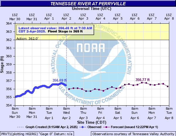
Critical Stages
362' - Action
365' - Flood
368' - Moderate
375' - Major
Latest Observation
Updated: 11:30 PM CST 12/4/25
Status: No Flooding
Stage: 354.95 ft
Flow: -999 kcfs
Forecast
| Time | Stage (ft) | Flow (kcfs) |
|---|---|---|
| 6 AM 12/5 | 354.81 | -999 |
| 12 PM 12/5 | 354.9 | -999 |
| 6 PM 12/5 | 354.86 | -999 |
| 12 AM 12/6 | 354.93 | -999 |
| 6 AM 12/6 | 354.92 | -999 |
| 12 PM 12/6 | 354.98 | -999 |
| 6 PM 12/6 | 354.91 | -999 |
| 12 AM 12/7 | 354.95 | -999 |
| 6 AM 12/7 | 354.91 | -999 |
| 12 PM 12/7 | 354.97 | -999 |
| 6 PM 12/7 | 354.87 | -999 |
| 12 AM 12/8 | 354.85 | -999 |
| 6 AM 12/8 | 354.95 | -999 |
| 12 PM 12/8 | 354.94 | -999 |
| 6 PM 12/8 | 354.84 | -999 |
| 12 AM 12/9 | 354.85 | -999 |
| 6 AM 12/9 | 354.93 | -999 |
| 12 PM 12/9 | 354.94 | -999 |
| 6 PM 12/9 | 354.84 | -999 |
| 12 AM 12/10 | 354.92 | -999 |
| 6 AM 12/10 | 354.94 | -999 |
| 12 PM 12/10 | 354.95 | -999 |
| 6 PM 12/10 | 354.88 | -999 |
| 12 AM 12/11 | 354.97 | -999 |
| 6 AM 12/11 | 354.95 | -999 |
| 12 PM 12/11 | 354.94 | -999 |
| Time | Stage (ft) | Flow (kcfs) |
|---|---|---|
| 11:30 PM 12/4 | 354.95 | -999 |
| 11:15 PM 12/4 | 354.94 | -999 |
| 11:00 PM 12/4 | 354.94 | -999 |
| 10:45 PM 12/4 | 354.93 | -999 |
| 10:30 PM 12/4 | 354.92 | -999 |
| 10:15 PM 12/4 | 354.92 | -999 |
| 10:00 PM 12/4 | 354.92 | -999 |
| 9:45 PM 12/4 | 354.91 | -999 |
| 9:30 PM 12/4 | 354.91 | -999 |
| 9:15 PM 12/4 | 354.91 | -999 |
| 9:00 PM 12/4 | 354.91 | -999 |
| 8:45 PM 12/4 | 354.91 | -999 |
| 8:30 PM 12/4 | 354.9 | -999 |
| 8:15 PM 12/4 | 354.91 | -999 |
| 8:00 PM 12/4 | 354.92 | -999 |
| 7:45 PM 12/4 | 354.92 | -999 |
| 7:30 PM 12/4 | 354.93 | -999 |
| 7:15 PM 12/4 | 354.93 | -999 |
| 7:00 PM 12/4 | 354.94 | -999 |
| 6:45 PM 12/4 | 354.95 | -999 |
| 6:30 PM 12/4 | 354.95 | -999 |
| 6:15 PM 12/4 | 354.96 | -999 |
| 6:00 PM 12/4 | 354.96 | -999 |
| 5:45 PM 12/4 | 354.96 | -999 |
| 5:30 PM 12/4 | 354.96 | -999 |
| 5:15 PM 12/4 | 354.96 | -999 |
| 5:00 PM 12/4 | 354.96 | -999 |
| 4:45 PM 12/4 | 354.96 | -999 |
| 4:30 PM 12/4 | 354.96 | -999 |
| 4:15 PM 12/4 | 354.96 | -999 |
383' -
In Decatur County, water begins to flood homes at the south end of Woodlawn Shores Road and Bill Perry Drive, and in the Lick Creek area.
380.5' -
In Decatur County, water reaches structures in the Lost Creek Boat Dock and Landing area.
376.5' -
In Decatur County, most campsites are flooded at Perryville Marina.
376' -
In Perry County, portions of the Cedar Creek Boat Dock and Marina become inundated, including nearby homes on Rusty Lane.
375.5' -
In Decatur County, water reaches the restaurant at the Fisherdale Landing Dock and Marina.
375' -
In Decatur County, the south end of Miracle Road at Fishers Landing floods.
374.5' -
In Decatur County, flooding of mobile home lots near the south end of Fishers Landing is occurring.
374' -
In Decatur County, houses are flooding at Yarbro Landing.
373.5' -
In Decatur County, water completely covers all of the shoreline campsites in the Perryville Marina and Campground.
372' -
In Decatur County, at Cherokee Heights, the entrance to the parking lot of the boat launch area is flooded. Main evacuation road to Lost Creek Boat Dock and Landing closes.
371' -
In Perry County, a majority of the Crooked Creek Campground and Marina is flooded. Homes near the boat launch on Toms Creek Boat Dock Road in the Toms Creek and Roan Creek areas become flooded.
370' -
In Decatur County, the first floor of the southernmost house in the Peevahouse Camp Lane area floods.
369' -
In Perry County, Crooked Creek Road is closed near the camping and boat launch area.
368.5' -
In Decatur County, the field just south of the mouth of Cub Creek is almost entirely inundated.
368' -
In Perry County, structures in the Crooked Creek Campground and Marina become inundated. Water also inundates portions of Blunts Landing Road south of Highway 412. Access may be limited.
367' -
In Perry County, Deer Creek Road to Riverfront Subdivision is flooded. In Decatur County in Cherokee Heights, water begins to flood the intersection of Divider Drive and Bill Perry Drive at the nouth end of Woodlawn Shores. Water also begins to flood the access road to Yarbro Landing. Water reaches the intersection of Brodies Landing Road and Sears Lane, and is flooding the boat ramp area of the Perryville Landing access area.
366.5' -
In Decatur County, the Fishers Landing evacuation route is being closed. The Perryville Marina campground may need to be evacuated. The Brodies Landing boat launch area and fields south of Cub Creek are flooding. Water also inundates the northeast end of the campground at Beech Bend Park.
366' -
In Perry County, parts of Crooked Creek Road near the river are flooded, along with the camping area at the mouth of Crooked Creek. In Mousetail Landing State Park, campsites in the park and the parking area at Spring Creek Landing are flooding.
365.5' -
In Decatur County, in Cherokee Heights, the intersection of Bill Perry Road and Woodland Shores Road floods near the boat launch area. Water begins to flood the Gumdale Landing boat launch parking area. The Busseltown boat launch area at the end of Mouse Tail Road is flooded. The Brodies Landing boat launch area is flooding. The south evacuation route from Fishers Landing is flooding. The road in front of Lost Creek Boat Dock and Marina closes.
364.5' -
In Decatur County, low-lying portions of Perryville Marina parking lot and evacuation roads become flooded. At the Gumdale Marina, water reaches the road leading north to Fisher Landing, and water inundates lots on the south end of Fisher Landing. Access to Gumdale may be limited. Inundation of the boat launch area at the end of Mouse Tail Road and Willow Oaks evacuation road occurs.
364' -
In Perry County, the evacuation road to the boat launch and camping area at the end of Deer Creek Boat Dock Road begins to flood.
363.5' -
In Decatur County, water inundates the boat launch area at the north end of Woodlawn Shores Road in Cherokee Heights and the low-lying areas of the boat launch at the end of Brodies Landing Road. The north end of Miracle Road in Fishers Landing is flooding. The evacuation road from Beech Bend Park boat parking lot floods.
363' -
In Decatur County, boat launch parking lot at Cherokee Heights is flooded. Access road to Beech Bend Park boat parking area is being flooded. Water tops boat ramp at Gumdale Marina and Fisherdale Landing area. Water begins to cover road in front of the Lost Creek Marina and Boat Dock. Access to Lost Creek Boat Dock may be limited.
362.5' -
In Decatur County, water begins to inundate the boat launch area on Woodlawn Shores Road in Cherokee Heights.
362' -
In Perry County, Crooked Creek Campground and Marina near the boat launch area is flooding along with the access road to the camping area near the mouth of Crooked Creek.
| Date | Stage (ft) |
|---|---|
| Mar 1, 1897 | 380.9 |
| Feb 27, 2019 | 378.2 |
| Mar 21, 1973 | 377.8 |
| May 13, 2003 | 377.1 |
| May 13, 1984 | 376 |
| Feb 17, 1948 | 374.2 |
| Dec 28, 1990 | 373.82 |
| Dec 13, 2004 | 373.67 |
| May 3, 2011 | 373.67 |
| Jan 15, 1974 | 373.52 |
| Jan 14, 1946 | 373.45 |
| Feb 23, 1991 | 373.3 |
| Feb 7, 1957 | 373.07 |
| Mar 18, 1975 | 372.32 |
| Mar 2, 1962 | 371.45 |
| Mar 25, 1980 | 371.4 |
| May 4, 2010 | 371.28 |
| Mar 18, 1963 | 370.52 |
| Apr 2, 1994 | 370.52 |
| Mar 8, 1997 | 370.17 |
Data provided by the National Weather Service.