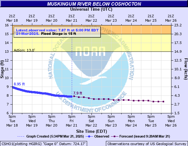
Muskingum River below Coshocton
Critical Stages
13' - Action
15' - Flood
18' - Moderate
20' - Major
Latest Observation
Updated: 12:00 AM EST 12/5/25
Status: No Flooding
Stage: 6.55 ft
Flow: 2.2 kcfs
Forecast
| Time | Stage (ft) | Flow (kcfs) |
|---|---|---|
| 1 AM 12/5 | 6.5 | 2.14 |
| 7 AM 12/5 | 6.6 | 2.26 |
| 1 PM 12/5 | 6.6 | 2.26 |
| 7 PM 12/5 | 6.6 | 2.26 |
| 1 AM 12/6 | 6.6 | 2.26 |
| 7 AM 12/6 | 6.6 | 2.26 |
| 1 PM 12/6 | 6.6 | 2.26 |
| 7 PM 12/6 | 6.6 | 2.26 |
| 1 AM 12/7 | 6.6 | 2.26 |
| 7 AM 12/7 | 6.5 | 2.14 |
| 1 PM 12/7 | 6.5 | 2.14 |
| 7 PM 12/7 | 6.5 | 2.14 |
| 1 AM 12/8 | 6.5 | 2.14 |
| 7 AM 12/8 | 6.5 | 2.14 |
| 1 PM 12/8 | 6.5 | 2.14 |
| 7 PM 12/8 | 6.5 | 2.14 |
| 1 AM 12/9 | 6.5 | 2.14 |
| 7 AM 12/9 | 6.4 | 2.01 |
| Time | Stage (ft) | Flow (kcfs) |
|---|---|---|
| 12:00 AM 12/5 | 6.55 | 2.2 |
| 11:45 PM 12/4 | 6.55 | 2.2 |
| 11:30 PM 12/4 | 6.55 | 2.2 |
| 11:15 PM 12/4 | 6.55 | 2.2 |
| 11:00 PM 12/4 | 6.55 | 2.2 |
| 10:45 PM 12/4 | 6.55 | 2.2 |
| 10:30 PM 12/4 | 6.55 | 2.2 |
| 10:15 PM 12/4 | 6.55 | 2.2 |
| 10:00 PM 12/4 | 6.56 | 2.21 |
| 9:45 PM 12/4 | 6.56 | 2.21 |
| 9:30 PM 12/4 | 6.56 | 2.21 |
| 9:15 PM 12/4 | 6.56 | 2.21 |
| 9:00 PM 12/4 | 6.56 | 2.21 |
| 8:45 PM 12/4 | 6.56 | 2.21 |
| 8:30 PM 12/4 | 6.55 | 2.2 |
| 8:15 PM 12/4 | 6.55 | 2.2 |
| 8:00 PM 12/4 | 6.55 | 2.2 |
| 7:45 PM 12/4 | 6.55 | 2.2 |
| 7:30 PM 12/4 | 6.55 | 2.2 |
| 7:15 PM 12/4 | 6.55 | 2.2 |
| 7:00 PM 12/4 | 6.55 | 2.2 |
| 6:45 PM 12/4 | 6.55 | 2.2 |
| 6:30 PM 12/4 | 6.54 | 2.19 |
| 6:15 PM 12/4 | 6.54 | 2.19 |
| 6:00 PM 12/4 | 6.54 | 2.19 |
| 5:45 PM 12/4 | 6.53 | 2.18 |
| 5:30 PM 12/4 | 6.53 | 2.18 |
| 5:15 PM 12/4 | 6.52 | 2.16 |
| 5:00 PM 12/4 | 6.52 | 2.16 |
| 4:45 PM 12/4 | 6.52 | 2.16 |
23' -
Flood waters will close most of Routes 16 and 83 in Coshocton. Flooding may begin to flood homes and businesses in and around South Water Street and South 2nd Street. Portions of Route 36 may be affected by flood waters.
21.98' -
Waters reach record flooding levels reached back on January 26, 1937.
21' -
Flooding could close portions of Route 83. Routes 16 and 36 may begin flooding in lower areas. Flood waters may begin to reach the Route 16/541 interchange.
20' -
Flood waters could affect most homes and businesses along County Route 1A. Portions of Route 83 may be flooded. Flooding may reach the low lying areas around the Route 16/541 interchange.
18' -
Moderate flooding occurs along County Route 1A and lower areas along Route 16 south. Widespread flooding occurs from the Lake Park area south to near the intersection of Routes 83 and 36. Homes around North Water Street in Coshocton floods.
16' -
Flood waters begin to affect the Lake Park area along the Walhonding River and begins backwater flooding along Mill Creek north of Lake Park and along Route 83. Flood waters will begin to enter yards in low-lying areas along County Route 1A.
15' -
Low areas are flooded and water reaches a few homes along Route 16 south of Coshocton and along County Route 1A north of Coshocton.
13' -
Water reaches low lying areas between Tuscarawas and Walhonding Rivers just upstream of the confluence of the two rivers.
| Date | Stage (ft) |
|---|---|
| Jan 26, 1937 | 21.98 |
| Jan 7, 2005 | 19.4 |
| Jan 5, 2004 | 18 |
| Mar 20, 2019 | 17.96 |
| Mar 11, 2011 | 17.71 |
| Mar 20, 2020 | 17.69 |
| Dec 30, 1990 | 17.58 |
| Feb 18, 2022 | 17.51 |
| Mar 7, 2011 | 17.42 |
| Mar 19, 2008 | 17.37 |
| Feb 16, 2018 | 17.18 |
| Mar 20, 2008 | 17.13 |
| Jan 28, 1994 | 17.12 |
| Feb 13, 2019 | 16.9 |
| Jan 16, 2007 | 16.88 |
| Jun 14, 2004 | 16.8 |
| Mar 7, 2008 | 16.7 |
| Sep 14, 1979 | 16.65 |
| Apr 8, 2000 | 16.5 |
| Apr 2, 2024 | 16.43 |
Data provided by the National Weather Service.