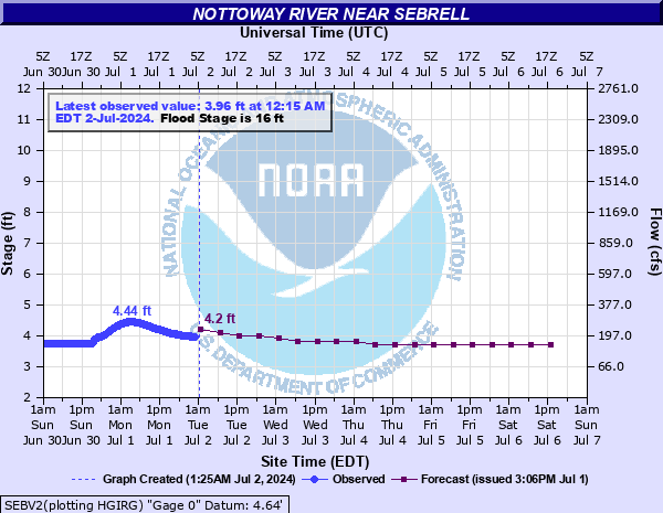
Nottoway River near Sebrell
Critical Stages
14' - Action
16' - Flood
18' - Moderate
21' - Major
Latest Observation
Updated: 8:15 AM EST 12/6/25
Status: No Flooding
Stage: 5.44 ft
Flow: 0.501 kcfs
Forecast
| Time | Stage (ft) | Flow (kcfs) |
|---|---|---|
| 1 PM 12/6 | 5.5 | 0.515 |
| 7 PM 12/6 | 5.5 | 0.515 |
| 1 AM 12/7 | 5.4 | 0.491 |
| 7 AM 12/7 | 5.3 | 0.468 |
| 1 PM 12/7 | 5.3 | 0.468 |
| 7 PM 12/7 | 5.2 | 0.445 |
| 1 AM 12/8 | 5.2 | 0.445 |
| 7 AM 12/8 | 5.1 | 0.423 |
| 1 PM 12/8 | 5.1 | 0.423 |
| 7 PM 12/8 | 5 | 0.402 |
| 1 AM 12/9 | 4.9 | 0.381 |
| 7 AM 12/9 | 4.9 | 0.381 |
| 1 PM 12/9 | 4.9 | 0.381 |
| 7 PM 12/9 | 4.8 | 0.359 |
| 1 AM 12/10 | 4.8 | 0.359 |
| 7 AM 12/10 | 4.8 | 0.359 |
| 1 PM 12/10 | 4.7 | 0.339 |
| 7 PM 12/10 | 4.7 | 0.339 |
| 1 AM 12/11 | 4.7 | 0.339 |
| 7 AM 12/11 | 4.7 | 0.339 |
| Time | Stage (ft) | Flow (kcfs) |
|---|---|---|
| 8:15 AM 12/6 | 5.44 | 0.501 |
| 8:00 AM 12/6 | 5.44 | 0.501 |
| 7:45 AM 12/6 | 5.44 | 0.501 |
| 7:30 AM 12/6 | 5.44 | 0.501 |
| 7:15 AM 12/6 | 5.44 | 0.501 |
| 7:00 AM 12/6 | 5.44 | 0.501 |
| 6:45 AM 12/6 | 5.44 | 0.501 |
| 6:30 AM 12/6 | 5.43 | 0.498 |
| 6:15 AM 12/6 | 5.43 | 0.498 |
| 6:00 AM 12/6 | 5.43 | 0.498 |
| 5:45 AM 12/6 | 5.43 | 0.498 |
| 5:30 AM 12/6 | 5.43 | 0.498 |
| 5:15 AM 12/6 | 5.42 | 0.496 |
| 5:00 AM 12/6 | 5.42 | 0.496 |
| 4:45 AM 12/6 | 5.42 | 0.496 |
| 4:30 AM 12/6 | 5.42 | 0.496 |
| 4:15 AM 12/6 | 5.42 | 0.496 |
| 4:00 AM 12/6 | 5.42 | 0.496 |
| 3:45 AM 12/6 | 5.41 | 0.493 |
| 3:30 AM 12/6 | 5.41 | 0.493 |
| 3:15 AM 12/6 | 5.41 | 0.493 |
| 3:00 AM 12/6 | 5.41 | 0.493 |
| 2:45 AM 12/6 | 5.4 | 0.491 |
| 2:30 AM 12/6 | 5.4 | 0.491 |
| 2:15 AM 12/6 | 5.4 | 0.491 |
| 2:00 AM 12/6 | 5.4 | 0.491 |
| 1:45 AM 12/6 | 5.4 | 0.491 |
| 1:30 AM 12/6 | 5.39 | 0.489 |
| 1:15 AM 12/6 | 5.39 | 0.489 |
| 1:00 AM 12/6 | 5.39 | 0.489 |
25.9' -
River stage sensor operating limit
24.19' -
Stage of the 25-year flood.
24' -
Entrance road to public boat ramp, 300 yards west of the gauge on Carys Bridge Road, State Route 653, begins to flood.
21.9' -
Stage of the 10-year flood.
20.13' -
Stage of the 5-year flood.
20' -
Water crosses Indian Town Road and US Highway 58 Business in Courtland.
19' -
Sections of State Route 653, Carys Bridge Road are innundated, including areas 1/4 mile east of the bridge crossing the Nottoway River.
18.5' -
Hancock Peanut Mill is affected in Courtland.
16' -
Water begins to cover Old Forty Road, State Route 634, in Sussex County. Additionally, Peters Bridge boat landing and portions of the Chub Sandhill Natural Area Preserve begin to flood, approximately 5 miles upstream of gage.
14' -
Public parking lot near boat ramp, 1000 ft upstream of gage, is flooded.
| Date | Stage (ft) |
|---|---|
| Aug 20, 1940 | 29.7 |
| Sep 19, 1999 | 26.98 |
| Sep 23, 2003 | 24.71 |
| Jul 22, 1945 | 24.5 |
| Jul 19, 1975 | 24.43 |
| Oct 11, 1972 | 24.13 |
| Mar 1, 1979 | 23.28 |
| May 10, 1958 | 21.8 |
| Oct 29, 1971 | 21.44 |
| May 1, 1978 | 21.32 |
| Mar 24, 1998 | 21.31 |
| Apr 13, 2003 | 20.76 |
| Apr 21, 1987 | 20.66 |
| May 31, 2003 | 20.62 |
| Nov 9, 1985 | 20.39 |
| Jan 11, 1962 | 20.26 |
| Sep 8, 2000 | 19.71 |
| Jan 14, 2024 | 19.7 |
| Oct 1, 1975 | 19.69 |
| Mar 7, 1994 | 19.66 |
Data provided by the National Weather Service.